Navigation apps, including Google Maps, Waze, and Apple Maps, have become must-have companions for millions of drivers worldwide. They make the road more predictable by showing traffic data, upcoming turns, and ETAs and help make driving to an unfamiliar destination more convenient.
However, navigation apps have a terrible, ugly side that authorities have tried to battle for years.
Waze is the best example. Its routing engine is a fantastic way to find a faster route to the destination, as it looks for traffic jams and other slowdowns drivers could encounter and suggests alternative routes to get a better ETA. Waze has generally been better at finding a faster route to a destination than Google Maps, albeit all navigation apps suffer from the same problem.
Because its purpose is to find the fastest route to the destination, Waze can sometimes include small and quiet residential streets in its suggested routes. Some of these roads were not designed to handle heavy traffic, but due to Waze looking for faster routes, they ended up struggling with tens, hundreds, or thousands of cars using them as shortcuts to their destinations.
The disruption caused to these communities is obvious, as locals complain that cars following Waze increase pollution and noise.
Now, Google Maps faces a similar problem, albeit on a different level.
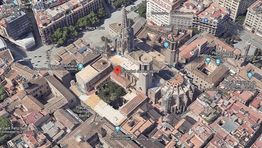
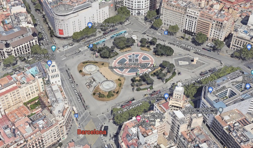
Barcelona is one of the biggest tourist attractions worldwide, with statistics estimating that approximately 10 million people visit the city every year.
We've known for a while that Google transformed Google Maps into an all-in-one mapping platform, so in addition to car navigation and turn-by-turn guidance, the application is also a valuable resource for tourists trying to find a certain location. Google Maps includes walking directions and public transportation information, so relying on its information makes exploring a city very convenient.
Naturally, many tourists who visit Barcelona use Google Maps for information on how to find and travel to a location. It's how line 116, a minibus going through the Gracia district, has become a popular tourist ride.
Because the minibus stops at Park Guell, a popular attraction for tourists visiting Barcelona, the line became a common search on Google Maps. The only problem is that the minibus on this line has room for only 20 people. With 10 million tourists every year, it's easy to see where this is going. The minibus is typically filled with tourists, leaving locals with no option but to wait for the next bus or eventually walk to their destination.
Authorities in the region complained that elderly locals have been having a hard time going anywhere, as line 116 became unusable due to tourists with backpacks. Finding a seat in the minibus was impossible, with residents waiting for the next minibus, hoping the hordes of tourists would leave at least enough room to get on board.
The local officials found a surprisingly effective solution to the problem. They removed the bus line from Google Maps, so tourists no longer use number 116 to travel in Barcelona. Tourists have become rare on board the minibus, as it's only used by people whose travel information isn't based on Internet data.
The Barcelona city hall originally believed that such a measure would be ridiculous and ineffective, but it turns out that most tourists did rely on Google Maps to travel in the neighborhood. Because the route is no longer on Google Maps, they find other ways to visit Park Guell.
Google Maps keeps evolving in ways that make exploring a region more convenient, and features like Immersive View allow users to discover a new city from the comfort of their sofa. Street View also makes street exploration as easy as 1-2-3, albeit the competition on this front is becoming fierce.
Long-time rival Apple has also started investing in a similar feature more aggressively. Known as Look Around, Apple's Street View alternative is part of a major Apple Maps transformation that includes first-party maps with rich details like medians, crosswalks, and sidewalks. Apple's long-term goal is to transform Apple Maps into a more advanced alternative to Google Maps, offering competing features with improved details and features.
For example, iOS 17, the latest iPhone operating system, includes support for offline maps. The feature allows users to navigate to a destination without an Internet connection. It's been available in Google Maps for many years, but Apple also integrated support for public transportation, making it easier for users to find transit directions to a destination even in areas with no cellular signal. In Google Maps, an Internet connection is required to use public transportation.
Google did not comment on Barcelona's decision to remove the bus line from Google Maps, but the company must comply with such requirements when requested by city officials. The Barcelona bus line has also been removed from other mobility apps, so it shouldn't be available in Apple Maps either.
Waze is the best example. Its routing engine is a fantastic way to find a faster route to the destination, as it looks for traffic jams and other slowdowns drivers could encounter and suggests alternative routes to get a better ETA. Waze has generally been better at finding a faster route to a destination than Google Maps, albeit all navigation apps suffer from the same problem.
Because its purpose is to find the fastest route to the destination, Waze can sometimes include small and quiet residential streets in its suggested routes. Some of these roads were not designed to handle heavy traffic, but due to Waze looking for faster routes, they ended up struggling with tens, hundreds, or thousands of cars using them as shortcuts to their destinations.
The disruption caused to these communities is obvious, as locals complain that cars following Waze increase pollution and noise.
Now, Google Maps faces a similar problem, albeit on a different level.
We've known for a while that Google transformed Google Maps into an all-in-one mapping platform, so in addition to car navigation and turn-by-turn guidance, the application is also a valuable resource for tourists trying to find a certain location. Google Maps includes walking directions and public transportation information, so relying on its information makes exploring a city very convenient.
Naturally, many tourists who visit Barcelona use Google Maps for information on how to find and travel to a location. It's how line 116, a minibus going through the Gracia district, has become a popular tourist ride.
Because the minibus stops at Park Guell, a popular attraction for tourists visiting Barcelona, the line became a common search on Google Maps. The only problem is that the minibus on this line has room for only 20 people. With 10 million tourists every year, it's easy to see where this is going. The minibus is typically filled with tourists, leaving locals with no option but to wait for the next bus or eventually walk to their destination.
The local officials found a surprisingly effective solution to the problem. They removed the bus line from Google Maps, so tourists no longer use number 116 to travel in Barcelona. Tourists have become rare on board the minibus, as it's only used by people whose travel information isn't based on Internet data.
The Barcelona city hall originally believed that such a measure would be ridiculous and ineffective, but it turns out that most tourists did rely on Google Maps to travel in the neighborhood. Because the route is no longer on Google Maps, they find other ways to visit Park Guell.
Long-time rival Apple has also started investing in a similar feature more aggressively. Known as Look Around, Apple's Street View alternative is part of a major Apple Maps transformation that includes first-party maps with rich details like medians, crosswalks, and sidewalks. Apple's long-term goal is to transform Apple Maps into a more advanced alternative to Google Maps, offering competing features with improved details and features.
For example, iOS 17, the latest iPhone operating system, includes support for offline maps. The feature allows users to navigate to a destination without an Internet connection. It's been available in Google Maps for many years, but Apple also integrated support for public transportation, making it easier for users to find transit directions to a destination even in areas with no cellular signal. In Google Maps, an Internet connection is required to use public transportation.
Google did not comment on Barcelona's decision to remove the bus line from Google Maps, but the company must comply with such requirements when requested by city officials. The Barcelona bus line has also been removed from other mobility apps, so it shouldn't be available in Apple Maps either.


