If you’ve been using the likes of Google Maps for more than one day, you probably know that such navigation apps aren’t by any means flawless.
And their main shortcoming is, perhaps, the digital maps they rely on, as the smallest change that happens on the road and is not properly signaled by the navigation app can completely ruin the experience for the poor fellow behind the wheel.
Take, for example, road closures. Roadworks that aren’t announced by authorities and, therefore, not flagged in navigation apps, either by the parent companies or by volunteers (as it’s the case with Google Maps), could completely break down the routing model used by the software people rely on so much every day.
In other words, Google Maps could end up sending you on a route that includes a closed road (or, at least, a small section of it), all because the application has no idea that the road is no longer open to traffic.
Keeping these digital maps completely up-to-date has been a massive challenge for pretty much every company investing in this space. The most efficient approach so far appears to be the one that Google Maps and Waze rely on and which pretty much comes down to a gigantic volunteer community that takes care of such a thing. Because both apps have map editors in almost every single part of the world, they can maintain local maps and update them accordingly.
But even so, keeping everything fully up-to-date and properly flagging the changes in real time isn’t possible. Not to mention that every app that offers digital maps would, therefore, have to invest in building a community of map editors before anything else.
HERE, however, has come up with a different and brilliant approach.
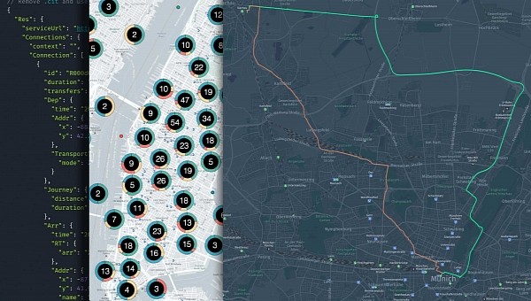
Called UniMap, the company’s latest project is supposed to make the creation and updating of digital maps a process that’s not only smoother, but also faster. Furthermore, UniMap allows customers to create their own private maps, but at the same time, HERE says it’ll also use the same technology for its very own digital maps.
So how does UniMap manage to be so fast when it comes to keeping maps updated?
First and foremost, HERE says that it’ll employ multiple sources to make sure its data is up-to-date. While Google relies on Google Maps cars that scan the roads for new digital maps, HERE will bet big on vehicle probe and sensor data. HERE’s software is already installed in millions of cars on the road, so the company says that it can use their sensors to collect all kinds of data, including the positioning of road signs.
Thanks to this process, which includes both 2D and 3D data, HERE is able to not only validate speed limits, the direction of travel, and other road information, but also to build missing road geometry. Of course, the amount of data the company would have to process is insane, but HERE says the whole thing has been designed from the very beginning to be as automated as possible. As a result, its AI systems can process no more, no less than 500 million kilometers of data every hour.
At the same time, HERE also relies on vehicle cameras and LiDAR sensors to compare the data it collects, so at the end of the day, it creates a unified map that includes not only up-to-date information, but also accurate details on what’s happening on the road.
Digital maps can be used for a wide variety of purposes, including navigation and automated driving, and intelligent speed assistance.
While the permanent data collection and the AI-powered data processing technically allow updates to be shipped in seconds (so maps can be updated almost in real time), HERE says that the changes happening on the road will most often become visible on the map within 24 hours. This means no human input is required, so the mapmaking process can take place with less staff involved.
Furthermore, HERE emphasizes that UniMap can be further enhanced with custom solutions developed by private companies. For example, a crowdsourcing engine could help add more accuracy to each digital map, while also validating certain changes with the help of customers already on the road. This would also speed up the process of bringing changes detected in the physical reality to digital maps.
HERE says the development of this new technology spanned over three full years, and one of the biggest companies that contributed to the project was BMW Group. In other words, we should expect BMW to be one of the first companies to adopt UniMap.
The navigation specialist says the new platform is projected to become available for the first customers at some point this year, but on the other hand, we’d better not hold our breath for a global release. This is scheduled to happen for all HERE customers by 2024, but no specific ETA has been offered so far.
Take, for example, road closures. Roadworks that aren’t announced by authorities and, therefore, not flagged in navigation apps, either by the parent companies or by volunteers (as it’s the case with Google Maps), could completely break down the routing model used by the software people rely on so much every day.
In other words, Google Maps could end up sending you on a route that includes a closed road (or, at least, a small section of it), all because the application has no idea that the road is no longer open to traffic.
Keeping these digital maps completely up-to-date has been a massive challenge for pretty much every company investing in this space. The most efficient approach so far appears to be the one that Google Maps and Waze rely on and which pretty much comes down to a gigantic volunteer community that takes care of such a thing. Because both apps have map editors in almost every single part of the world, they can maintain local maps and update them accordingly.
But even so, keeping everything fully up-to-date and properly flagging the changes in real time isn’t possible. Not to mention that every app that offers digital maps would, therefore, have to invest in building a community of map editors before anything else.
HERE, however, has come up with a different and brilliant approach.
Called UniMap, the company’s latest project is supposed to make the creation and updating of digital maps a process that’s not only smoother, but also faster. Furthermore, UniMap allows customers to create their own private maps, but at the same time, HERE says it’ll also use the same technology for its very own digital maps.
First and foremost, HERE says that it’ll employ multiple sources to make sure its data is up-to-date. While Google relies on Google Maps cars that scan the roads for new digital maps, HERE will bet big on vehicle probe and sensor data. HERE’s software is already installed in millions of cars on the road, so the company says that it can use their sensors to collect all kinds of data, including the positioning of road signs.
Thanks to this process, which includes both 2D and 3D data, HERE is able to not only validate speed limits, the direction of travel, and other road information, but also to build missing road geometry. Of course, the amount of data the company would have to process is insane, but HERE says the whole thing has been designed from the very beginning to be as automated as possible. As a result, its AI systems can process no more, no less than 500 million kilometers of data every hour.
At the same time, HERE also relies on vehicle cameras and LiDAR sensors to compare the data it collects, so at the end of the day, it creates a unified map that includes not only up-to-date information, but also accurate details on what’s happening on the road.
Digital maps can be used for a wide variety of purposes, including navigation and automated driving, and intelligent speed assistance.
Furthermore, HERE emphasizes that UniMap can be further enhanced with custom solutions developed by private companies. For example, a crowdsourcing engine could help add more accuracy to each digital map, while also validating certain changes with the help of customers already on the road. This would also speed up the process of bringing changes detected in the physical reality to digital maps.
HERE says the development of this new technology spanned over three full years, and one of the biggest companies that contributed to the project was BMW Group. In other words, we should expect BMW to be one of the first companies to adopt UniMap.
The navigation specialist says the new platform is projected to become available for the first customers at some point this year, but on the other hand, we’d better not hold our breath for a global release. This is scheduled to happen for all HERE customers by 2024, but no specific ETA has been offered so far.


