You'd think that working for Apple and driving all day to capture imagery for Apple Maps is an easy job, but driving an Apple car (not that kind of Apple Car) might sometimes end up with a fine.
Recent Look Around imagery spotted by eagle-eyed redditor Mashdash10 and shared on the social platform shows the Apple Maps car doing something not quite legal. And potentially being asked to explain what they just did.
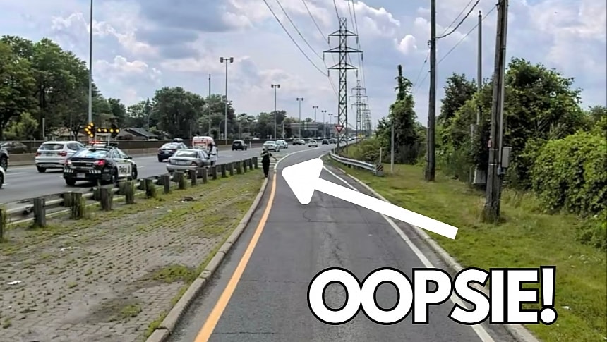
The Apple Maps car was scanning Montreal for updated imagery in Canada when they entered a bus-only street. You can tell the road is restricted to buses from the signage, with one photo even showing a bus heading in the same direction as the Apple Maps car.
Oddly, a police car is stopped on the main road, just behind a grey Nissan, possibly as the officer pulled over the vehicle. Some Redditors believe the police car was there to ensure a security corridor behind the Nissan as the car broke down. Regardless of the reason, the police vehicle was already there when the Apple Maps car entered the bus-only road, so the officer easily spotted the vehicle approaching from the restricted street.
The Apple Maps imagery shows the officer approaching the vehicle, pulling it over, talking to the driver, and eventually letting them go, with or without a ticket, as the photos don't include evidence of a ticket that may have been issued. However, the Apple Maps car continues its trip, entering the highway to capture more data for Look Around.
While some people seem to believe the Apple Maps car should be allowed anywhere, just like service vehicles, that is not the case. Apple is a private company, it doesn't offer public services, and these roads are restricted to public buses for obvious reasons. The Apple Maps car must comply with the same restrictions as any passenger vehicle,
Meanwhile, the Cupertino-based tech giant is working around the clock on capturing more data and getting the detailed city experience ready for more users. The job started on this major update earlier this decade when Apple promised a major Apple Maps transformation, and while the new experience has already been rolled out in some regions, the broad availability phase is not on the radar yet.
The detailed city experience allows Apple Maps to migrate from third-party to first-party maps, with Apple in charge of the information presented to users. The new maps include more details, such as medians, sidewalks, and crosswalks, and the update also integrates additional capabilities, such as Waze-inspired traffic reporting and Look Around. Apple is expected to announce the next phase of the DCE rollout in the coming weeks, possibly just ahead of the WWDC event, where it could share more Apple Maps news.


