The sat-nav software space may be dominated by Google Maps and Waze, but navigation experts like TomTom and Sygic are now investing big in their mobile apps too.
TomTom GO Navigation is an application that promises to do it all, in some ways serving as a mix of Google Maps and Waze with upgraded capabilities.
As such, TomTom’s software also provides information about traffic on your route, eventually trying to make every journey more predictable. In an approach similar to Waze, GO Navigation shows the road sectors where slowdowns occur, eventually using this information to look for faster routes and generate more accurate ETAs.
TomTom GO Navigation uses TomTom’s own data, whereas Google Maps and Waze rely on aggregate data collected by Google, traffic reports sent by users, and sometimes the information they share with each other.
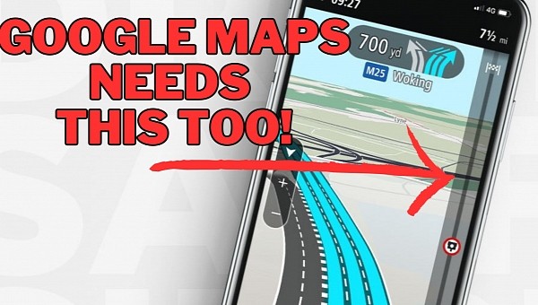
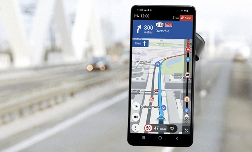
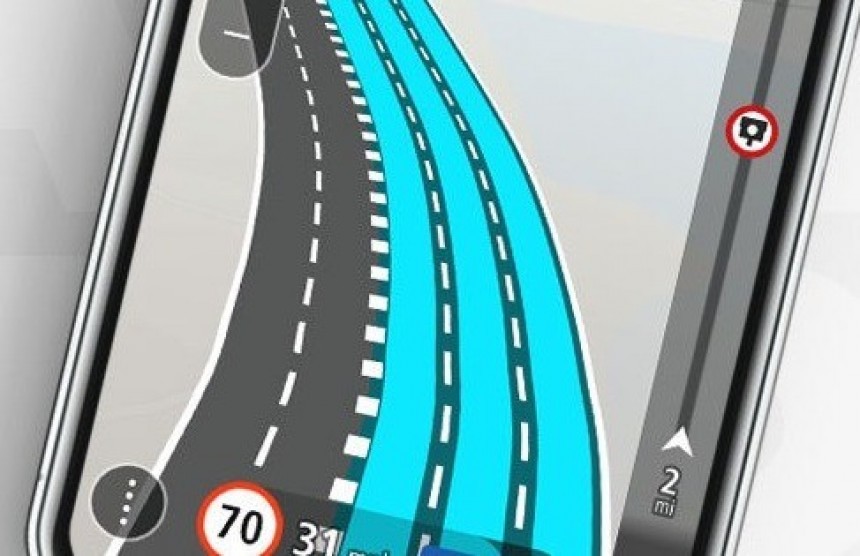
The route bar displays essential information such as the ETA to the destination but also the reported incidents. Like Waze, TomTom GO Navigation uses dedicated icons to warn of traffic jams, construction zones, and speed cameras. They are displayed in the route bar whenever they are reported on the road ahead.
Worth knowing is that the route bar doesn’t display every single incident. This is because TomTom wanted to keep the feature as efficient as possible and making it cluttered by adding all traffic reports defeated this purpose. As a result, it only displays major incidents that could eventually cause a significant delay.
The map view allows you to take a peek at the route ahead. TomTom uses symbols and different colors to indicate the location of notable events along the route, such as road closures, fog, rain, wind, roadworks, or accidents. Different colors and stripes are used for traffic conditions – a dark red indicator with stripes moving slowly indicates that traffic speed is 0 to 20 percent of the allowed speed. As such, you can tell in advance that this is where you are likely to experience a major slowdown.
When sitting in traffic, you can explore the route in map view and tap the icons that are displayed on the screen. TomTom GO Navigation then offers additional context, letting you know in advance why some incidents have been marked on the map.
For example, if you notice a traffic incident, you can tap its icon to find out how heavy the traffic jam is expected to be. TomTom shows essential information, such as its severity and the delay time. Additionally, the company also tries to estimate the length of the incident.
In the case of a traffic report, you could be told you’re about to come across slow traffic that happens for a 700-meter section of your route.
This is an approach similar to the one used by Waze. The Google-owned traffic navigation app also allows users to get more information on the incidents ahead. In some cases, the provided details are even more relevant thanks to its crowdsourcing engine.
In Waze, users are allowed to comment on traffic incidents and even post images. This means the other motorists on the road can share additional information on what’s happening on your route. In the case of roadworks, they can include photos taken with their phone cameras to show how the incident is impacting traffic.
TomTom hopes the route bar would make a big difference in this regard. When approaching a traffic jam, the route bar zooms in to highlight how far you are from the moment where you are expected to encounter it. The route bar uses the color-coded approach to indicate how heavy the traffic jam is expected to be and shows the distance to its starting point. A warning symbol is also displayed, and a notification sound is produced to make you aware of the traffic jam.
Waze also comes with a feature similar to the route bar, but it only shows up during traffic jams. The company developed it specifically to indicate how long drivers could spend in heavy traffic, showing their progress as they move toward the end of the jam. This bar is displayed only when spending a considerable amount of time in heavy traffic.
In theory, TomTom’s route bar also gives you enough time to take an alternative route to avoid traffic jams. Sure enough, this isn’t always possible, and the parent company itself emphasizes that, in some cases, the fastest route is still the one with the traffic jam. Finding an alternative route around the traffic jam may not be possible if none exists in the first place.
As such, TomTom’s software also provides information about traffic on your route, eventually trying to make every journey more predictable. In an approach similar to Waze, GO Navigation shows the road sectors where slowdowns occur, eventually using this information to look for faster routes and generate more accurate ETAs.
TomTom GO Navigation uses TomTom’s own data, whereas Google Maps and Waze rely on aggregate data collected by Google, traffic reports sent by users, and sometimes the information they share with each other.
The route bar and its role in TomTom GO Navigation
To make the journey more predictable, TomTom has invented a so-called route bar that stays on the screen during navigation. The feature’s purpose is as simple as it could be: showing a quick preview of the route ahead, along with the most notable events you are likely to come across.The route bar displays essential information such as the ETA to the destination but also the reported incidents. Like Waze, TomTom GO Navigation uses dedicated icons to warn of traffic jams, construction zones, and speed cameras. They are displayed in the route bar whenever they are reported on the road ahead.
The map view allows you to take a peek at the route ahead. TomTom uses symbols and different colors to indicate the location of notable events along the route, such as road closures, fog, rain, wind, roadworks, or accidents. Different colors and stripes are used for traffic conditions – a dark red indicator with stripes moving slowly indicates that traffic speed is 0 to 20 percent of the allowed speed. As such, you can tell in advance that this is where you are likely to experience a major slowdown.
When sitting in traffic, you can explore the route in map view and tap the icons that are displayed on the screen. TomTom GO Navigation then offers additional context, letting you know in advance why some incidents have been marked on the map.
For example, if you notice a traffic incident, you can tap its icon to find out how heavy the traffic jam is expected to be. TomTom shows essential information, such as its severity and the delay time. Additionally, the company also tries to estimate the length of the incident.
In the case of a traffic report, you could be told you’re about to come across slow traffic that happens for a 700-meter section of your route.
In Waze, users are allowed to comment on traffic incidents and even post images. This means the other motorists on the road can share additional information on what’s happening on your route. In the case of roadworks, they can include photos taken with their phone cameras to show how the incident is impacting traffic.
TomTom hopes the route bar would make a big difference in this regard. When approaching a traffic jam, the route bar zooms in to highlight how far you are from the moment where you are expected to encounter it. The route bar uses the color-coded approach to indicate how heavy the traffic jam is expected to be and shows the distance to its starting point. A warning symbol is also displayed, and a notification sound is produced to make you aware of the traffic jam.
Waze also comes with a feature similar to the route bar, but it only shows up during traffic jams. The company developed it specifically to indicate how long drivers could spend in heavy traffic, showing their progress as they move toward the end of the jam. This bar is displayed only when spending a considerable amount of time in heavy traffic.
In theory, TomTom’s route bar also gives you enough time to take an alternative route to avoid traffic jams. Sure enough, this isn’t always possible, and the parent company itself emphasizes that, in some cases, the fastest route is still the one with the traffic jam. Finding an alternative route around the traffic jam may not be possible if none exists in the first place.


