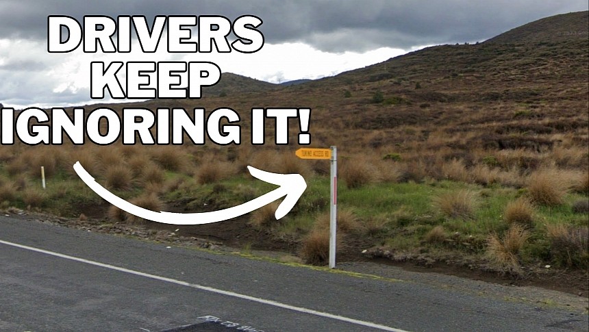
Google Maps, Waze, and Apple Maps are fantastic tools that make driving to an unfamiliar destination as easy as 1-2-3. But the tiniest glitch in the matrix can wreak havoc on the road, eventually sending drivers to other locations if they ignore road signs.
Google's navigation software sent drivers in New Zealand to the wrong side of the mountain earlier this week due to an error the search giant couldn’t fix promptly.
Local media reports that drivers who followed turn-by-turn instructions in Google Maps to reach Ruapehu’s Sky Waka gondola ride eventually arrived at the Tukino ski field.
Most people showed up at the ski center with pre-paid gondola passes and wearing sneakers, unprepared for (and surprised by) the freezing snow. Drivers also struggled with an 18-kilometer (11-mile) road only suitable for all-wheel-drive vehicles, mainly because they did not have the proper tire. They just followed Google Maps' instructions, ignoring the street signage and heading to a destination that was two hours drive away from the place they were searching for.
Ski field operators say they helped everybody return to their vehicles, especially because they wore regular shoes on slippery surfaces.
They claim that Google Maps has been sending people to the wrong side of the mountain for several weeks, revealing that Google only addressed the problem after several social media posts.
Google has remained tight-lipped on the problem, explaining that it quickly addresses errors in its navigation software.
The navigation mishap likely results from incorrect editing through the crowdsourcing component. Users can suggest location changes in Google Maps, though it's unclear how Ruapehu’s Sky Waka gondola ride's address pointed to Tukino's ski field.
Unfortunately, drivers continue to rely exclusively on Google Maps for navigation information without paying the tiniest attention to the signs on the side of the road. Street signage is still critical regardless of what the navigation software says, especially because such solutions lack 100 percent accuracy. While Google Maps and Waze use crowdsourcing to stay up-to-date with what happens on the road, changes taking place in real time aren't always reflected in their navigation engines.
As a result, road signs are the only ones providing 100% accurate information, especially regarding closed roads and destinations.
Google Maps blunders can sometimes prove fatal. In 2020, two Russians who used the navigation software to find a faster route decided to take a highway exit and drive on an alternate route suggested by the application. Google Maps directed them on a snow-covered closed road, where their vehicle eventually got stuck. The two Russians eventually lost the cellular signal, with the driver freezing to death due to the brutally cold Siberian winter. Emergency teams found the passenger after several days with life-threatening injuries.


