Most people believe Google Maps is just a navigation app whose role is to take you from where you are to where you want to be. They're not wrong, as Google Maps excels in terms of navigation capabilities, but the application has significantly evolved beyond this concept.
Google Maps is now a new-generation tool to find places, explore the world, and get information on specific locations, and the latest announcement helps the application expand further in this regard.
The Mountain View-based search giant has recently announced "the biggest expansion" of the Lens integration in Maps, allowing users to discover their surroundings by scanning them with the mobile phone camera.
Here's how everything works.
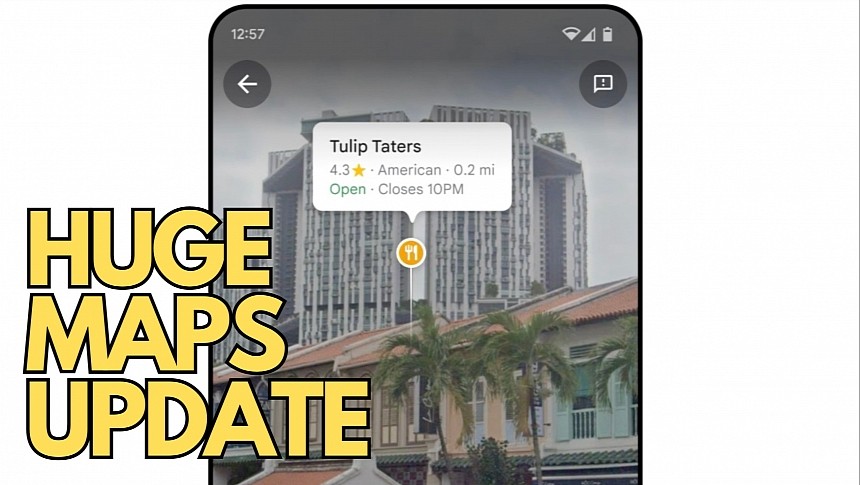
Many years ago, Google launched a feature called Search with Live View, allowing users to activate the game in Google Maps and get information on the locations around them by moving around with the phone's camera activated. By scanning the surroundings, Google Maps was able to detect businesses, restaurants, landmarks, and other places available on the map and show them on top of the images captured by the camera using augmented reality.
As a result, users could see a restaurant's name, the Google rating, and the opening hours by simply pointing the phone's camera at it.
The feature was eventually renamed to Lens, with Google adding a dedicated icon in the Google Maps search box to make launching it more convenient. Google originally offered Lens integration into a limited number of regions, but the company is now bringing it to more than 50 cities as part of what it describes as "the biggest expansion of this feature yet."
The feature is launching in Austin, Las Vegas, Rome, Sao Paulo, Taipei, and others. If you want to know if it's available for you, the easiest way to figure this out is by launching Google Maps and looking for the Lens icon in the search box.
The Lens integration in Google Maps is part of a massive update announced this week by the search giant. The update comes alongside important new additions, including Immersive View for routes, which lets users explore their Google Maps in a realistic multi-dimensional view before starting driving. Immersive View uses satellite imagery and Street View photos mixed with traffic information and weather conditions to generate a simulated version of the world.
Drivers can preview their routes and get familiar with every turn while obtaining a more accurate and convenient look at the expected traffic conditions. The weather forecast helps drivers understand how the route could look when they leave on a journey and how they could impact traffic conditions.
Immersive View for routes is available only in a limited number of regions, but Google has already promised to expand it to more locations, likely in the first half of 2024.


