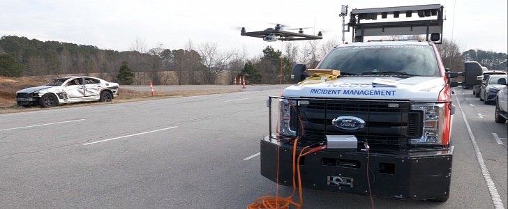
Improving road safety is just one of the many applications UAVs (unmanned aerial vehicles) can have and North Carolina is the first one in the U.S. to deploy tethered drones for that exact purpose.
In what is described as a national first by the North Carolina Department of Transportation (NCDOT), two pilot programs are being launched, in which drones will help responders assess crashes and other incidents assisting with the overall traffic management. The two programs are IMAP (Incident Management Assistance Patrol) and UAS (Division of Aviation’s Unmanned Aircraft System) and they’ll both use advanced technology to enhance situation awareness.
Wherever the IMAP patrols operate, tethered drones will be deployed to help fill those gaps in camera coverage, providing valuable information in real-time and delivering higher quality video. They will represent just another useful resource in addition to the multiple specialized tools IMAP trucks are equipped with.
North Carolina will use Fotokite drones that can fly up to 150 ft (45 m), take video and livestream it to the personnel on their way to/at the scene of the incident. The drones are easy to launch and recover, as well as highly portable.
As part of the national pilot announced by the NCDOT, the IMAP team will test two tethered drone systems. A first operation in the field already took place in January, where a drone stayed in the air for approximately five continuous hours above Fayetteville to survey a crash near the U.S. 13 and Interstate 95 interchange.
If the pilot proves successful, the NCDOT’s Traffic Operations section will consider the future deployment of tethered drones to help increase road safety.
Meanwhile, on another continent, Lithuania is also using drones to automatize road inspections, switching from conventional vehicles to UAVs that can video analyze the condition of the country’s national roads. It is an initiative meant to reduce Lithuania’s carbon footprint, with these drones being able to cut emissions by up to 90 percent.
Back to the North Carolina pilot, you can see footage of a Fotokite drone being launched in the video below.


