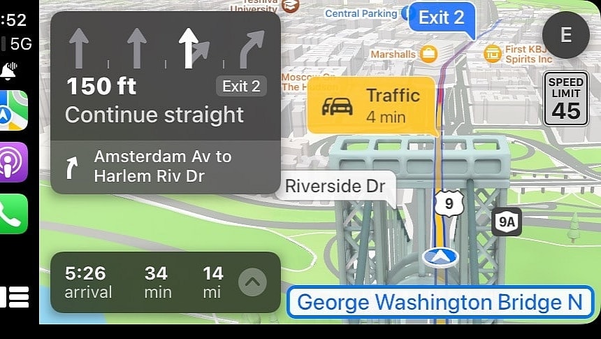
One of the biggest benefits of Internet-connected navigation apps is the support for real-time traffic information. Thanks to this feature, these solutions can offer more advanced capabilities, including more accurate ETAs, hazard warnings, and better routes.
Real-time traffic data allows navigation apps to search for multiple routes to the destination, letting drivers choose the option that fits them best.
Most navigation apps, including Google Maps and Waze, already offer such functionality. In its attempt to catch up, Apple is exploring multiple ways to improve Apple Maps, including a new method to allow drivers to pick the best route.
A patent called "devices and methods for comparing and selecting alternative navigation routes" describes how the proposed update would work, with Apple explaining that the new features would be available on a "touch-sensitive screen."
Theoretically, it means Apple Maps would offer the alternative route selection engine on iPhones, but the chances are that a similar functionality would also debut on CarPlay.
Here are the most important tidbits in the patent.
Apple explains its purpose is to "facilitate intuitive comparison and selection of calculated navigation routes." In plain English, it wants the available routes to be displayed in a more convenient manner on the route selection screen so that users can see the ETA, the distance, and the main events on the route more easily.
If you've used a navigation app, you probably know that choosing a route typically comes down to the ETA. If a route is faster, the likelihood of a user choosing it is much higher, as everybody wants to arrive at the destination in the shortest time.
However, Apple envisions an alternative route engine that displays more details on the same screen so you can see additional information before choosing a route.
The proposed interface includes three suggested routes when driving mode is enabled – Apple calls them "navigation tiles" and route "pictorials."
Each tile displays the proposed route with the starting and ending points, the distance to the destination, the travel time, the total cost of tolls, and a traffic indicator. If Apple Maps is aware of important hazards on a route (such as via crowdsourcing – the incident reporting engine that allows users to flag the location of hazards on the map), the application displays a warning in the respective tile. Users can, therefore, choose their route to avoid the reported hazard.
Apple Maps would also include additional configuration settings so that users would be allowed to choose what information they want to see on the screen when the application calculates the available routes.
For example, the settings screen would include toggles for the route name, the total distance, the travel time, the toll price, and the ETA. More options would also be offered for route priority, including minimum distance and time. The routes can also be configured to avoid tolls, highways, traffic, bridges, and tunnels.
One particular setting that caught my attention is a toggle for "scenic routes." Users have long been asking for such a setting, but most navigation companies ignored the request, focusing on the fastest routes to the destination and eco-friendly alternatives. If Apple pursues this idea, Apple Maps could end up offering scenic routes, allowing users to enjoy beautiful scenery while driving to the destination.
Apple has become more committed to improving Apple Maps, and despite this alternative route selection screen not bringing a major overhaul to the app, it helps make it more convenient when looking for the best route.
The company has big plans for Apple Maps, especially as it dropped the Apple car project. Apple's automotive strategy now revolves around software, and Apple Maps is one of the products likely to receive more attention in the coming years.
The latest major iOS update included support for offline maps. Like Google Maps, Apple Maps allows users to navigate to their destinations without an Internet connection. However, they must download offline maps when an Internet connection is still available, with Apple Maps switching to locally stored data when your device loses the cellular signal.
The upcoming iOS update due in the fall will include additional new features, including support for custom routes that users can build on their computers. If you've been using Google Maps in the last few years, you probably know how convenient it is to plan a complex route on a larger screen. Google allows users to do this in the web-based version of Google Maps, and when they're ready, they can forward the route to their mobile devices using a Google account.
Apple will use a similar approach for Apple Maps, but the planning phase will happen in the Apple Maps app on macOS. Users can submit routes to their iPhones and CarPlay using an Apple ID. Apple will likely share more information about this update and other improvements at WWDC next month. The next major iOS update will go live in the fall.
Most navigation apps, including Google Maps and Waze, already offer such functionality. In its attempt to catch up, Apple is exploring multiple ways to improve Apple Maps, including a new method to allow drivers to pick the best route.
A patent called "devices and methods for comparing and selecting alternative navigation routes" describes how the proposed update would work, with Apple explaining that the new features would be available on a "touch-sensitive screen."
Theoretically, it means Apple Maps would offer the alternative route selection engine on iPhones, but the chances are that a similar functionality would also debut on CarPlay.
Here are the most important tidbits in the patent.
If you've used a navigation app, you probably know that choosing a route typically comes down to the ETA. If a route is faster, the likelihood of a user choosing it is much higher, as everybody wants to arrive at the destination in the shortest time.
However, Apple envisions an alternative route engine that displays more details on the same screen so you can see additional information before choosing a route.
The proposed interface includes three suggested routes when driving mode is enabled – Apple calls them "navigation tiles" and route "pictorials."
Apple Maps would also include additional configuration settings so that users would be allowed to choose what information they want to see on the screen when the application calculates the available routes.
For example, the settings screen would include toggles for the route name, the total distance, the travel time, the toll price, and the ETA. More options would also be offered for route priority, including minimum distance and time. The routes can also be configured to avoid tolls, highways, traffic, bridges, and tunnels.
Apple has become more committed to improving Apple Maps, and despite this alternative route selection screen not bringing a major overhaul to the app, it helps make it more convenient when looking for the best route.
The company has big plans for Apple Maps, especially as it dropped the Apple car project. Apple's automotive strategy now revolves around software, and Apple Maps is one of the products likely to receive more attention in the coming years.
The upcoming iOS update due in the fall will include additional new features, including support for custom routes that users can build on their computers. If you've been using Google Maps in the last few years, you probably know how convenient it is to plan a complex route on a larger screen. Google allows users to do this in the web-based version of Google Maps, and when they're ready, they can forward the route to their mobile devices using a Google account.
Apple will use a similar approach for Apple Maps, but the planning phase will happen in the Apple Maps app on macOS. Users can submit routes to their iPhones and CarPlay using an Apple ID. Apple will likely share more information about this update and other improvements at WWDC next month. The next major iOS update will go live in the fall.
