Waze transformed the navigation space with an approach no other tech company could copy. Owned by Google since 2013, Waze uses a crowdsourcing engine to determine road conditions and send warnings to drivers.
Users can submit traffic reports for accidents, potholes, traffic jams, speed traps, and other incidents. Waze collects the data and generates warnings for drivers whose routes go through the flagged hotspots.
Mercedes seemingly believes that collecting real-time data from the road helps improve traffic safety, so the company is exploring a method whose purpose is to provide drivers with warnings on hazard zones.
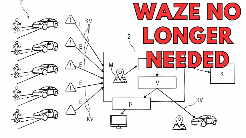
While Waze relies entirely on user data, the German carmaker's technology is fully automatic and doesn't require user input to generate reports. Mercedes says the onboard sensors, cameras, and other technology installed on the vehicle can collect the data and then upload it to a server for processing.
The company explains in a recent patent that its "method and device for identifying potential hazard zones in road traffic" can process hard braking, sudden steering, and other maneuvers as indicators of a potential hazard zone. The server generates a so-called hotspot once multiple vehicles upload similar data sets. The system can add contextual information, including the travel speed, the lane, the time of day, and traffic conditions. Based on the sensors that uploaded the data, the system can also submit images used by the central computer to generate a hotspot.
Once the technology flags a specific location as a potential hazard zone, it generates warnings submitted to other vehicles on the road. Drivers could see the area highlighted on the sav-nav system on the dashboard, along with acoustic and visual alerts. As a result, drivers have more time to reduce the vehicle speed, often being able to slow down before reaching the flagged location.
Mercedes says the system can be enhanced to be connected directly to traffic authorities that can take proper action to resolve hazard zones. It can also reduce the likelihood of accidents in high-risk zones, such as pedestrian crossings obstructed by overgrown vegetation.
The system involves manual confirmation for the flagged hotspots using an approach like the one integrated into Waze. Drivers getting a warning on the screen can confirm the hazard zones, though Mercedes says the same thing would be possible using the same sensors that reported in the incident in the first place. If a road hazard is no longer detected, drivers and automated systems can send relevant data, eventually allowing the server to remove the warning.
As with everything in the patent stage, Mercedes' idea looks brilliant on paper but is far from when it could receive the green light for mass-produced vehicles. Given the increased focus on autonomous cars and new-generation technology that could capture road data, the likelihood of such systems making their way to vehicles is on the rise.


