Navigation software has reached a point where the provided data is incredibly accurate, sometimes updated in almost real time.
Applications like Waze, for example, rely on information submitted by drivers on the road, eventually making other motorists aware of what’s happening ahead. Thanks to a large user community and map editors, these apps update data like speed limits and roadworks in a matter of minutes.
Despite this efficient approach, navigation apps still struggle to provide warnings on rapidly changing traffic conditions, such as variable speed.
Due to certain factors, such as roadworks, weather, or accidents, authorities could restrict the maximum allowed speed on certain sections of the road or lanes. As such, sat-nav solutions wouldn’t provide accurate information to users.
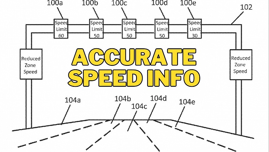
Navigation experts at HERE, a company whose solutions are often considered top alternatives to the likes of Google Maps and Waze, have come up with an idea to detect and estimate variable speed signs.
In a patent covering the technology, the firm explains that existing vehicle systems, such as onboard cameras, might not accurately detect speed limit indicators due to various factors, such as bad weather. As such, HERE proposes a more complex approach that relies on multiple information sources.
On the one hand, the speed limit information can be collected by onboard cameras, but HERE says it can then be compared against other data obtained either from surrounding vehicles or a central server. If available, a remote server can provide vehicles with speed limit information for the current section of the road or lane – this could work only if authorities or traffic agencies share such information.
Then, HERE explains, a vehicle could read speed limit information from road signs and compare it to other cars’ travel speeds. If the current speed aligns with what’s shown on the traffic indicator, the system assumes the camera read the allowed speed correctly. Using vehicle-to-vehicle connection, the technology can transmit the speed limits to other motorists, making everyone aware of the correct information. The more data is processed, the bigger the chances for the speed data to be accurate.
Eventually, the system can upload the obtained speed limit information to a server and allow it to be transmitted to other vehicles whose routes go through the same location. Drivers would be warned in advance that a variable speed indicator is on the route.
HERE’s technology could come in handy not only for navigation apps, which can eventually provide more accurate data to users, but also for autonomous vehicles. Variable speed signs would no longer impact self-driving capabilities regardless of traffic and weather conditions, as the onboard navigation would be in permanent connection with other vehicles already on the road.
Of course, the technology is still in the patent stage at the time of writing, so you’d better not hold your breath for HERE to bring it to fruition.
