The competition in the navigation space is getting fiercer, with the biggest players in the industry now coming with almost the same feature lineup.
Almost everything you find in Google Maps is also available in Apple Maps, Waze, Sygic, or TomTom navigation, so eventually, choosing your driving companion comes down to other factors such as the interface and various little differences.
It doesn't mean all these apps have the same feature lineup and purpose. Google Maps is an all-in-one mapping service, while Waze is primarily aimed at traffic navigation. Apple Maps wants to become a Google Maps killer, while navigation experts like TomTom, Sygic, and HERE target drivers with comprehensive packages built with finding the best route in mind.
Google Maps still has unique features, and one of them keeps me from turning to Apple Maps and Waze full-time. It's the way it offers traffic information, as it helps the route planning task a lot more convenient and straightforward.
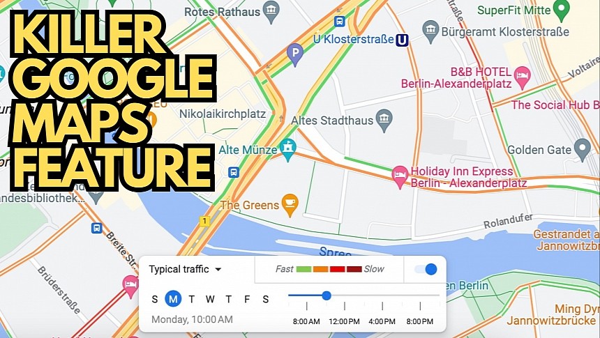
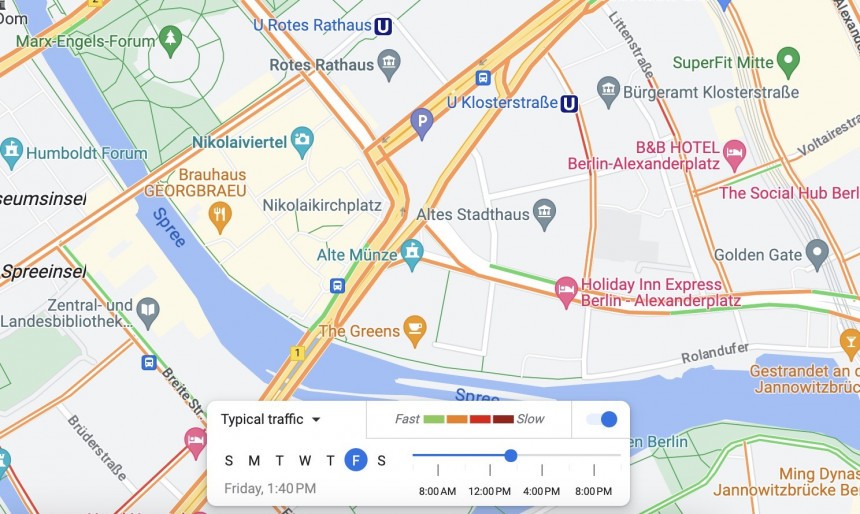
Like Apple Maps and Waze, Google Maps uses a color-coded approach to display traffic conditions in a specific region. Green means the road is clear, orange signals moderate traffic, while red and dark red warn of bumper-to-bumper traffic.
Apple Maps displays live traffic conditions for the default and the satellite layers, while Waze uses colored roads to warn of heavy traffic before you begin driving.
Traffic conditions change in real time and are impacted by even the tiniest road incident. A fender-bender can produce massive jams, so most applications help you see what's happening ahead in real time.
Let me tell you how I use this feature. I live right next to one of the busiest roundabouts in my city, and every day when I go to the gym, using my typical route is a major gamble. Depending on the time of day, the roundabout can be either clear or a massive parking space, causing up to 20-minute delays.
It's when Google Maps comes into play.
While Waze and Apple Maps allow me to see the live traffic conditions, Google Maps does both this and something much more advanced. It lets me check out traffic conditions as they change throughout the day. Google Maps does this using historical data so I can check how the roundabout could be in an hour or two.
I can, therefore, pick just the right time to go to the gym to enjoy a clear road. A clear road is more important than you think, as the route typically allows me to arrive at the gym in under 15 minutes. Heavy traffic significantly increases the ETA, as I could spend up to 20 minutes just to get past the roundabout.
Google Maps allows users to see traffic conditions as they change at 5-minute intervals. You can also choose different days to see the same data for the rest of the week. Google Maps also displays live traffic conditions if you want to see what a route looks like at any given moment.
The road color, which helps display traffic conditions, changes as you move the slider, so you can easily tell when you're more likely to come across a massive jam or reach your destination without encountering significant slowdowns.
Needless to say, you can always use Google Maps to find a faster route to the destination, but in this case, the best option is Waze. The Google-owned traffic navigation app uses the available traffic data to look for faster routes by avoiding slowdowns, sometimes suggesting better routes than Google Maps. However, the app doesn't come with an option to see traffic conditions as they change throughout the day.
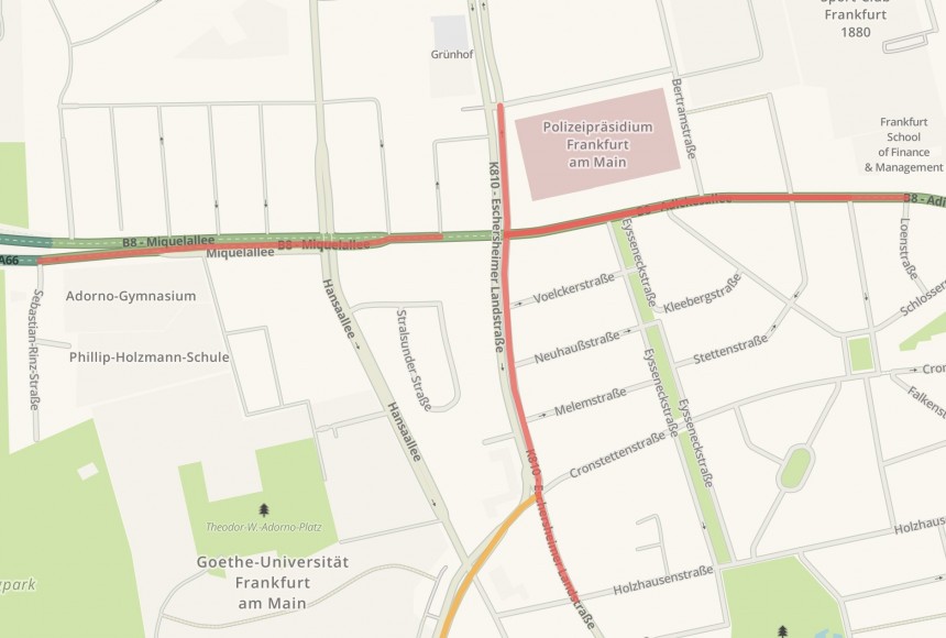
Apple Maps comes with traffic information in the default and the satellite layer, using a similar color-coded approach. Roads are painted green when they're clear and red when you're expected to encounter heavy traffic. Like Waze, Apple Maps doesn't display historical traffic information, so it only shows the current conditions.
Google Maps is the most complex mapping platform, offering options to navigate and explore the world from your device. Its navigation component is top-notch, and while its routes aren't always the fastest, or at least not as fast as those in Waze, features like the traffic information make a potential switch to an alternative hard.
The traffic data is available on mobile devices and the desktop, so you won't see the changing conditions throughout the day on Android Auto or CarPlay. Apple also shows live traffic information on the iPhone and macOS, while Waze shows real-time details on smartphones and the web via the Waze live map.
It doesn't mean all these apps have the same feature lineup and purpose. Google Maps is an all-in-one mapping service, while Waze is primarily aimed at traffic navigation. Apple Maps wants to become a Google Maps killer, while navigation experts like TomTom, Sygic, and HERE target drivers with comprehensive packages built with finding the best route in mind.
Google Maps still has unique features, and one of them keeps me from turning to Apple Maps and Waze full-time. It's the way it offers traffic information, as it helps the route planning task a lot more convenient and straightforward.
Why traffic information matters
Apple Maps displays live traffic conditions for the default and the satellite layers, while Waze uses colored roads to warn of heavy traffic before you begin driving.
Traffic conditions change in real time and are impacted by even the tiniest road incident. A fender-bender can produce massive jams, so most applications help you see what's happening ahead in real time.
How Google Maps displays traffic data
I already described the colored approach in another article, but what I like the most about Google Maps is how it allows me to choose the right time to leave based entirely on traffic conditions.Let me tell you how I use this feature. I live right next to one of the busiest roundabouts in my city, and every day when I go to the gym, using my typical route is a major gamble. Depending on the time of day, the roundabout can be either clear or a massive parking space, causing up to 20-minute delays.
It's when Google Maps comes into play.
While Waze and Apple Maps allow me to see the live traffic conditions, Google Maps does both this and something much more advanced. It lets me check out traffic conditions as they change throughout the day. Google Maps does this using historical data so I can check how the roundabout could be in an hour or two.
Google Maps allows users to see traffic conditions as they change at 5-minute intervals. You can also choose different days to see the same data for the rest of the week. Google Maps also displays live traffic conditions if you want to see what a route looks like at any given moment.
The road color, which helps display traffic conditions, changes as you move the slider, so you can easily tell when you're more likely to come across a massive jam or reach your destination without encountering significant slowdowns.
Needless to say, you can always use Google Maps to find a faster route to the destination, but in this case, the best option is Waze. The Google-owned traffic navigation app uses the available traffic data to look for faster routes by avoiding slowdowns, sometimes suggesting better routes than Google Maps. However, the app doesn't come with an option to see traffic conditions as they change throughout the day.
Google Maps is the most complex mapping platform, offering options to navigate and explore the world from your device. Its navigation component is top-notch, and while its routes aren't always the fastest, or at least not as fast as those in Waze, features like the traffic information make a potential switch to an alternative hard.
The traffic data is available on mobile devices and the desktop, so you won't see the changing conditions throughout the day on Android Auto or CarPlay. Apple also shows live traffic information on the iPhone and macOS, while Waze shows real-time details on smartphones and the web via the Waze live map.


