Like it or not, artificial intelligence systems are already part of our lives. The ones we average Joes interact with on a daily basis are rather simple things, coming as either personal assistants (Siri, Alexa, Google Assistant) or chatbots (ChatGPT, Bard, Grok).
As such, we tend to assign them simple and, most of the time, dumb tasks, like answering idiotic questions that have haunted us for ages. And then we go laugh our asses off as soon as we get an equally idiotic answer.
All these so-called AIs are, thus, nothing more than a sort of new means of entertainment for us humans. But that's technically not what AIs, the real ones, are meant for. They, the real AIs, could help our society far more than being vulgar when answering questions like "Do you like your name, Grok?"
And what you're about to read about here is just a small taste of that. It is, in fact, a "groundbreaking development" not only in the world of AIs, but also in how we understand, track, and see icebergs.
Icebergs are technically large chunks of freshwater that break off glaciers for various reasons. To qualify for the designation, they must be more than 15 meters (49 feet) long and float freely in open water.
Like them or not, icebergs are essential components of oceanic environments, especially in the Antarctic. Their presence and movement affect anything from the ocean's physics to its chemistry and biology. The way we humans operate our ships is also impacted by icebergs.
So, knowing where they are, where they are going, and how fast they melt and release meltwater is crucial to many of the serious things we humans do in the real world.
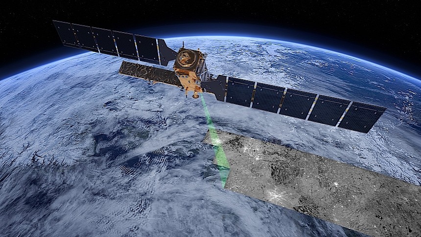
And that's why we keep a close eye on them. That's done, most of the time, with the help of satellites the likes of the Copernicus Sentinel-1, and others. These pieces of orbital hardware look down on areas of interest and snap images, either with camera-like instruments, or through radar means.
The images then have to go through a review process, with humans trying to piece together where icebergs are, how big, where they are going, and so on. And that can be very tricky, and it's incredibly time-consuming.
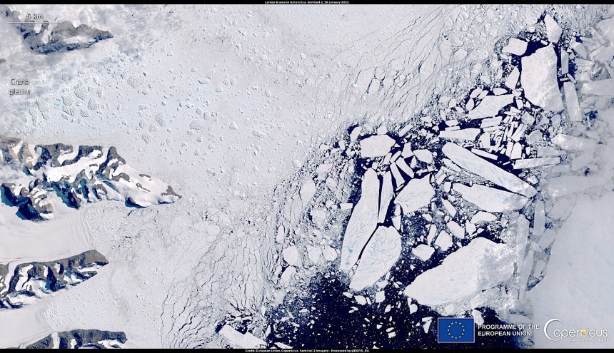
You see, satellite images snapped by cameras, the most widespread there are, are not very revealing in that icebergs, sea ice, and clouds appear all in white, and that makes identification quite hard for humans.
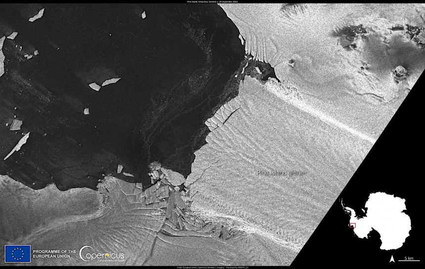
Radar images are a tad better as they are not impacted by cloud cover and the absence of sunlight and show icebergs as bright objects against a darker environment. Even so, it may be tricky for humans to set icebergs apart from coastlines and, on top of that, using human eyes and brains to process those images is quite time-consuming.
That's why a team from the University of Leeds is looking at a way of using a neural network to "swiftly and accurately chart the expanse of large Antarctic icebergs in satellite images." A method that is, according to the team's lead, Anne Braakmann-Folgmann, 10,000 times faster than human processing power.
The deep learning AI system, unnamed at this point, is based on the U-net design, something that was initially designed for biomedical image fragmentation. It was trained with data received from the Sentinel-1 that showed icebergs in various settings.
Seven such targets were used for the AI to get its bearings, with sizes ranging from 56 to 1,052 square km (27 to 406 square miles). With these images (a total of 191 were used) came a dataset with between 15 and 46 images for each iceberg, as snapped in the period ranging from 2014 to 2020.
As per the European Space Agency (ESA), one of the driving forces behind the iceberg monitoring effort, the AI was capable of identifying icebergs in just 0.01 seconds, and with an accuracy of 99 percent. The AI was capable of identifying the largest iceberg in each image, which we're told is quite something and quite an evolution from comparative methods.
The findings of this new iceberg-mapping effort were published by the team in the Cryosphere journal of the European Geosciences Union. It is regarded as "the first study to apply a deep neural network for iceberg segmentation" and the "first study specifically targeting giant icebergs."
As for what comes next, the team is looking to increase the training dataset for the AI in a bid to train it to find icebergs that are both smaller and larger than the ones detected during this trial run.
It's unclear when a technology that could reliably be used to find and track icebergs should be ready for deployment, but we do know one thing: we surely can't wait to learn more about this, rather than read about Grok's exploits on X.
All these so-called AIs are, thus, nothing more than a sort of new means of entertainment for us humans. But that's technically not what AIs, the real ones, are meant for. They, the real AIs, could help our society far more than being vulgar when answering questions like "Do you like your name, Grok?"
And what you're about to read about here is just a small taste of that. It is, in fact, a "groundbreaking development" not only in the world of AIs, but also in how we understand, track, and see icebergs.
Icebergs are technically large chunks of freshwater that break off glaciers for various reasons. To qualify for the designation, they must be more than 15 meters (49 feet) long and float freely in open water.
Like them or not, icebergs are essential components of oceanic environments, especially in the Antarctic. Their presence and movement affect anything from the ocean's physics to its chemistry and biology. The way we humans operate our ships is also impacted by icebergs.
So, knowing where they are, where they are going, and how fast they melt and release meltwater is crucial to many of the serious things we humans do in the real world.
The images then have to go through a review process, with humans trying to piece together where icebergs are, how big, where they are going, and so on. And that can be very tricky, and it's incredibly time-consuming.
You see, satellite images snapped by cameras, the most widespread there are, are not very revealing in that icebergs, sea ice, and clouds appear all in white, and that makes identification quite hard for humans.
Radar images are a tad better as they are not impacted by cloud cover and the absence of sunlight and show icebergs as bright objects against a darker environment. Even so, it may be tricky for humans to set icebergs apart from coastlines and, on top of that, using human eyes and brains to process those images is quite time-consuming.
That's why a team from the University of Leeds is looking at a way of using a neural network to "swiftly and accurately chart the expanse of large Antarctic icebergs in satellite images." A method that is, according to the team's lead, Anne Braakmann-Folgmann, 10,000 times faster than human processing power.
The deep learning AI system, unnamed at this point, is based on the U-net design, something that was initially designed for biomedical image fragmentation. It was trained with data received from the Sentinel-1 that showed icebergs in various settings.
As per the European Space Agency (ESA), one of the driving forces behind the iceberg monitoring effort, the AI was capable of identifying icebergs in just 0.01 seconds, and with an accuracy of 99 percent. The AI was capable of identifying the largest iceberg in each image, which we're told is quite something and quite an evolution from comparative methods.
The findings of this new iceberg-mapping effort were published by the team in the Cryosphere journal of the European Geosciences Union. It is regarded as "the first study to apply a deep neural network for iceberg segmentation" and the "first study specifically targeting giant icebergs."
As for what comes next, the team is looking to increase the training dataset for the AI in a bid to train it to find icebergs that are both smaller and larger than the ones detected during this trial run.
It's unclear when a technology that could reliably be used to find and track icebergs should be ready for deployment, but we do know one thing: we surely can't wait to learn more about this, rather than read about Grok's exploits on X.


