I’m pretty sure none of you reading this can imagine life without access to satellite navigation. And that’s true for me as well. I mean, sure, I can remember the time from before Waze and Google Maps. But as things stand now, returning to a physical, paper-printed map and having to find my way using that seems so… primitive.
Officially, the first GPS satellite was launched in 1978. It was called Navstar 1 and marked the beginning of a mammoth (in scope, not size) satellite constellation that more or less governs the way we move, and at times even how we live our lives.
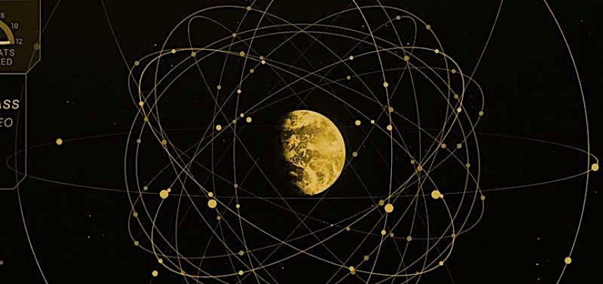
The concept of navigation satellites is so important for the society we run these days that we’ve even invented a name for them. Taken as a whole, the concept is called Global Navigation Satellite Systems (GNSS), but it comprises several separate constellations.
The most famous is the one called Global Positioning System. GPS for short, it's also the most used, hence the globally-adopted name of the technology. It comprises just 31 satellites and is run by the U.S. Space Force. Then there’s the European counterpart, something called Galileo and comprising 24 satellites. And, of course, we have Russia and China, each with their own constellations, called Glonass and BeiDou, respectively.
All these pieces of hardware have a single purpose: to provide us humans on Earth with guidance and positioning, be it for benign purposes like going on vacation to more aggressive ones like finding the right target to destroy. But did you know GNSS is used by spacecraft as well?
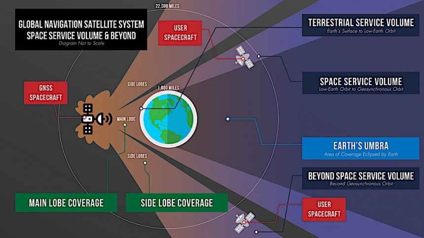
For a while now, spacecraft operating in the immediate vicinity of our planet have been using the GNSS not only to get their bearings, but also to keep time. And seeing how well that worked, NASA and its partners came up, just a short couple of decades ago, with ways for spacecraft located as far as 22,000 miles (35,400 km) from the surface of the planet to regularly use GNSS signals for their own purposes.
But what if we could use Earth’s GNSS to find our way over on the Moon? That’s about 240,000 miles (385,000 km) away, and you’d think it’s something not likely to happen. Think again, as NASA is about to test exactly such a capability.
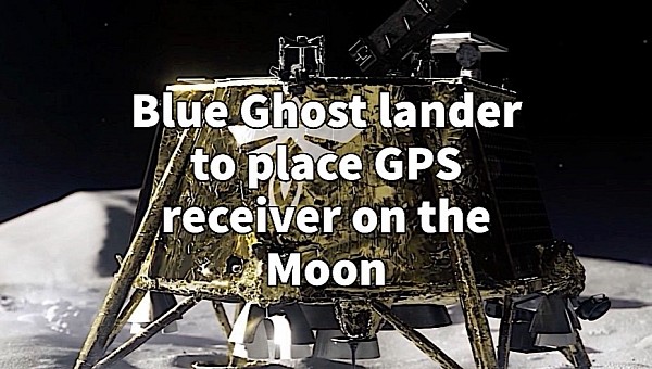
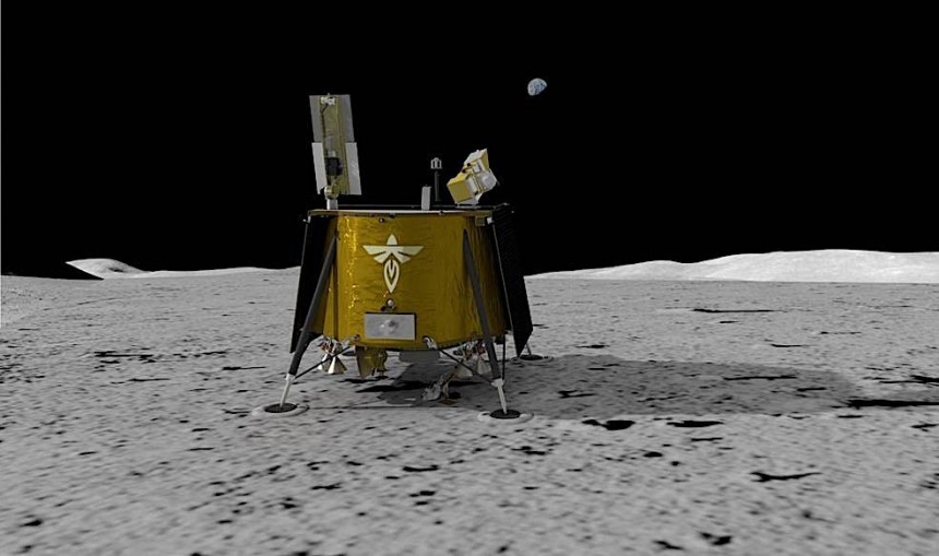
Sometime in 2024, a SpaceX Falcon 9 rocket is expected to launch a lunar lander called Blue Ghost. Made by a space company called Firefly, it will carry with it ten science investigations and technology demonstrations. Among them, there is something called the LuGRE.
LuGRE is short for Lunar GNSS Receiver Experiment, and it’s a NASA project conducted together with the Italian Space Agency. Physically, it’s a piece of hardware that comprises a weak-signal GNSS receiver, a high-gain L-band patch antenna, a low-noise amplifier, and an RF filter.
What this thing will do while on its mission is enter history books as the hardware that made possible, for the first time, the receiving of a GNSS signal on the surface of the Moon.
More to the point, LuGRE will receive signals from some of the American GPS and European Galileo satellites. It will start doing so while still en-route to the Moon, but once the lander sets down in the Mare Crisium region, LuGRE’s antenna will deploy and the real, 12-day-long (at least, as duration may be extended) research project will begin.
NASA says the technology will not only be used to receive GNSS signals, but also test a “lunar navigation capability.” What that means is that, for the first time ever, it will get GNSS location fixes not only while on the way to the Moon, but also on the lunar surface.
If it works, the experiment will open the doors to the creation of a lunar GNSS. At first, it will probably rely on satellites positioned in orbit around Earth, but later it will probably evolve into a dedicated system – and NASA has an ongoing project to this end, the so-called LunaNet lunar communications and navigation service.
If you have doubts GNSS signals can cover the large distance to the Moon, keep in mind that the Magnetospheric Multiscale Mission (MMS) probe broke two records on its own. It first used Earth satellite signals to get a position while at a distance of 43,500 miles (70,000 km) from home. That happened in 2016, but three years later the same probe managed to do even more, catching a GNSS signal while at a distance of more than double that: 116,300 miles (187,000 km). To put things into perspective, that’s almost halfway to the Moon.
Aside from the upcoming lunar missions themselves, the creation of a lunar comms and nav system is now perhaps humanity’s most important undertaking in space exploration. Without such a system in place, the proper exploration and colonization of the Moon (and later on, even Mars) will not happen to the extent we plan them.
As said, LuGRE departs in 2024, so we’re about a year away from learning how fast our expansion to other worlds is truly possible.
The concept of navigation satellites is so important for the society we run these days that we’ve even invented a name for them. Taken as a whole, the concept is called Global Navigation Satellite Systems (GNSS), but it comprises several separate constellations.
The most famous is the one called Global Positioning System. GPS for short, it's also the most used, hence the globally-adopted name of the technology. It comprises just 31 satellites and is run by the U.S. Space Force. Then there’s the European counterpart, something called Galileo and comprising 24 satellites. And, of course, we have Russia and China, each with their own constellations, called Glonass and BeiDou, respectively.
All these pieces of hardware have a single purpose: to provide us humans on Earth with guidance and positioning, be it for benign purposes like going on vacation to more aggressive ones like finding the right target to destroy. But did you know GNSS is used by spacecraft as well?
But what if we could use Earth’s GNSS to find our way over on the Moon? That’s about 240,000 miles (385,000 km) away, and you’d think it’s something not likely to happen. Think again, as NASA is about to test exactly such a capability.
Sometime in 2024, a SpaceX Falcon 9 rocket is expected to launch a lunar lander called Blue Ghost. Made by a space company called Firefly, it will carry with it ten science investigations and technology demonstrations. Among them, there is something called the LuGRE.
LuGRE is short for Lunar GNSS Receiver Experiment, and it’s a NASA project conducted together with the Italian Space Agency. Physically, it’s a piece of hardware that comprises a weak-signal GNSS receiver, a high-gain L-band patch antenna, a low-noise amplifier, and an RF filter.
More to the point, LuGRE will receive signals from some of the American GPS and European Galileo satellites. It will start doing so while still en-route to the Moon, but once the lander sets down in the Mare Crisium region, LuGRE’s antenna will deploy and the real, 12-day-long (at least, as duration may be extended) research project will begin.
NASA says the technology will not only be used to receive GNSS signals, but also test a “lunar navigation capability.” What that means is that, for the first time ever, it will get GNSS location fixes not only while on the way to the Moon, but also on the lunar surface.
If it works, the experiment will open the doors to the creation of a lunar GNSS. At first, it will probably rely on satellites positioned in orbit around Earth, but later it will probably evolve into a dedicated system – and NASA has an ongoing project to this end, the so-called LunaNet lunar communications and navigation service.
Aside from the upcoming lunar missions themselves, the creation of a lunar comms and nav system is now perhaps humanity’s most important undertaking in space exploration. Without such a system in place, the proper exploration and colonization of the Moon (and later on, even Mars) will not happen to the extent we plan them.
As said, LuGRE departs in 2024, so we’re about a year away from learning how fast our expansion to other worlds is truly possible.


