Crowdsourced traffic information is one of the best inventions in the navigation space, as it helps motorists stay up-to-date about what happens on their route before they reach a specific location.
Waze, for example, allows users to mark the location of various traffic hazards, such as potholes, accidents, roadkill, speed traps, and traffic jams, with other motorists receiving a notification on the screen if their routes go through the same checkpoints.
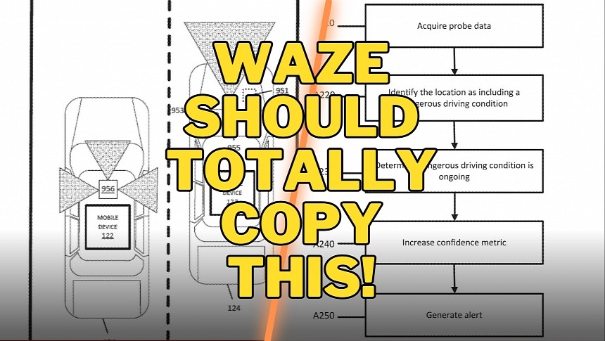
However, a crowdsourced navigation solution comes with several limitations, and HERE wants to address one of the most important. As a Google Maps alternative, HERE is heavily focused on improving navigation with innovative capabilities, and a patent application for a system to detect and monitor dangerous driving conditions is living proof on this front.
HERE wants its technology to automatically detect dangerous driving conditions on each lane, eventually being able to send a report to other motorists on the road. In other words, Waze wants to send warnings to drivers, but compared to Waze, the notifications wouldn't use crowdsourced data.
The system works by looking into data from multiple sources, including even from your mobile phone. For example, if you slam on the brakes or suddenly change direction, the system can collect the data and then investigate, validate, and verify the potentially dangerous driving conditions. HERE says the application can use cameras, sensors, and other sources of traffic information in the process, with machine learning performing the analysis automatically.
In theory, HERE's system can get data from phone and car sensors and use on-board vehicle cameras and even traffic cameras to determine if a certain lane or region is more likely to witness dangerous driving conditions. The company says the navigation system can determine the event type (such as heavy braking), probability, and time. It can then generate warnings that are sent to drivers via their navigation software.
Eventually, HERE says it can also train navigation solutions to take into account any slowdown that these dangerous conditions might produce. At the same time, the sat-nav can be updated with options to avoid these regions, eventually providing drivers with safer routes (though longer, these routes could help avoid dangerous driving conditions).
Needless to say, the obtained data can be used for navigation and other purposes. For example, traffic authorities can look into the reports and determine the regions where dangerous driving conditions are more likely to occur. They can also access the main triggers, eventually implementing restrictions or a series of measures to improve traffic safety.
At this point, HERE's idea is still in the patent stage, which means it's too early to tell about an actual implementation in its production software. On the other hand, with traffic systems getting more advanced features, this concept makes perfect sense, especially considering that an automatic system could be used on self-driving vehicles too.


