The default routing model in Google Maps looks for the fastest route to a user-defined destination. Starting in 2021, users in select regions can also search for eco-friendly alternatives, with Google Maps then displaying both the fastest and the fuel-saving options on the route preview screen.
Needless to say, most drivers stick with the fastest route configuration for obvious reasons. Thanks to this feature, they can reduce overall travel time, especially when facing heavy traffic conditions.
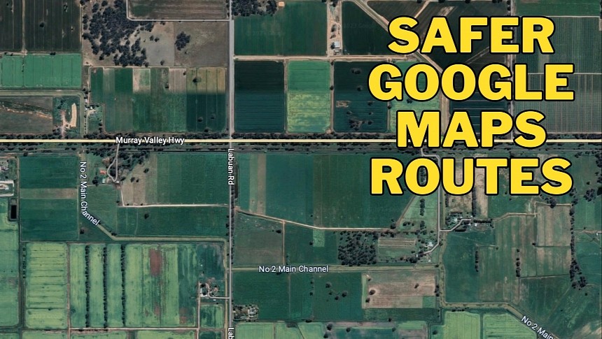
However, a faster route suggested to Australian drivers has been removed by Google after a fatal crash involving five victims. As it turns out, the route sent drivers on a regional Victorian road not suitable for heavy traffic.
The intersection of Labuan and Stokes roads and the Murray Valley Highway is known by locals as the site of major crashes. Residents have called for help on several occasions, and the police even conducted a safety audit recommending the introduction of a series of safety measures. However, the road continued to face heavy traffic, partially because Google Maps used it as a shortcut.
The traffic levels reached insane levels, especially during the holidays. Residents say they couldn’t even sleep at night because of the vehicles passing on the street, sometimes at high speed. Due to inefficient signage and a crest right before the intersection, drivers fail to slow down, eventually slamming on the brakes. The most recent accident happened on April 20, and it was the worst road crash in more than a decade.
The Google Maps team itself reached out to the Moira Shire Council to reveal the change in the routing model. Google removed Labuan Road from the Google Maps recommended route list, though it will still provide route guidance should drivers specifically request this road.
While authorities themselves are yet to address the problems, locals claim the traffic levels have already dropped after the change in Google Maps.
To determine the fastest route to a destination, Google takes into account data like real-time traffic information and historical patterns. The distance and the average travel time, calculated based on aggregate data from devices on the road, help determine the ETA. Once Google Maps determines a trip time for each route, it can determine the fastest one and suggest it to the user.
As such, Google Maps can end up sending drivers on secondary roads or unpaved streets (if this option is enabled), especially when traffic levels are high.
The rest of the navigation solutions use a similar approach, including Apple Maps. Waze also employs a crowdsourcing engine that allows users to send traffic reports and eventually determine slowdowns more effectively. Compared to Google Maps, Waze requires a permanent Internet connection to send and download traffic data.


