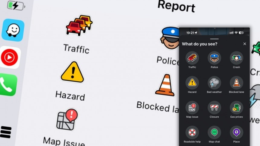
The police reports bundled with Waze have long been controversial, as many believe that allowing users to mark the location of speed traps allows speedsters to escape without a fine.
We've all seen how this works. Users running Waze and typically driving over the limit slow down when approaching a speed trap and accelerate immediately after passing it.
Several countries, including France, have banned police reports in mobile navigation apps specifically to prevent users from warning others about the location of law enforcement. Their reasoning, besides that a police report allows speedsters to escape unpunished, is that criminals could also use the data to avoid officers on the ground specifically searching for them.
Think of someone running away from the police. If they run Waze, they could use the police reports within the app to use only routes where patrol cars haven't been flagged.
However, police reports remain one of the main reasons people use Waze. And as it turns out, "police officers love Waze, too."
These are the words of the Ontario Provincial Police, who recently took to Facebook to share a piece of advice that motorists seem to support.
"If you use Waze, please mark us on the map," police say. And their reasoning makes sense.
The post explains that someone seeing a police report on Waze typically slows down. A driver typically going over the limit is more likely to use software or other tools to detect a speed trap, mainly to slow down in advance and avoid getting a ticket. Slowing down is what police should aim for (despite many motorists calling for bigger fines), and the Ontario Provincial Police says this is their goal, too.
"If you mark us on the map, it ensures that at least for the duration of enforcement, drivers will slow down, and that's what we're out here for," they say in the post.
The Ontario Provincial Police claim that speedsters slowing down eventually keeps others safe on the highway. Eventually, reporting police on Waze "could help save a life."
The Ontario Provincial Police might have a point here. Ensuring high visibility for speed traps is a deterrent for speedsters, providing enough time to slow down. Otherwise, many drivers could be tempted to brake hard when noticing a radar, increasing the likelihood of an accident and contributing to phantom traffic jams, especially on highways during rush hours.
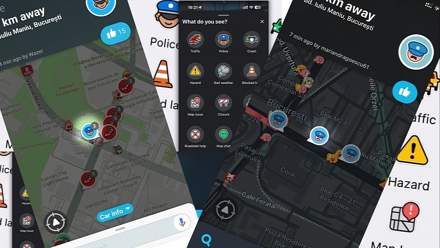
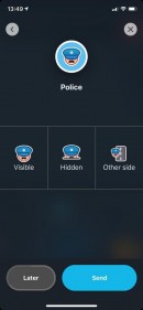
Waze allows users to send three types of police reports: the standard report for a visible speed trap, a hidden radar, and police on the other side.
The simplified Waze reporting experience, which has already launched on all supported platforms, including Android Auto and CarPlay, tested multiple approaches, at one point giving up on all options but the standard police trap. The reasoning was simple: drivers don't care what type of speed trap they encounter; all they want to know is that they approach a radar, so keeping visible and hidden reports available as separate options only made the reporting experience more cluttered.
Waze eventually removed the police on the other side report, trying to focus on a single report. This option eventually returned, as it could help users, especially when traffic is light on the other side and nobody flags the location of a speed trap.
Police reports have slowly made their way to other navigation apps. Google Maps and Apple Maps also support similar options, though their adoption is lackluster. Apple Maps adopted police reports as part of the incident reporting component, trying to explore the navigation experience beyond the standard turn-by-turn guidance. The incident reports are bundled with the detailed city experience rolling out across the world, so it's not yet available for all users. Apple Maps also allows users to report accidents and "other hazards."
Waze remains the most popular solution for sending traffic reports, and in addition to speed traps, users can also flag the location of accidents, traffic jams, flooding, roadkill, broken traffic lights, potholes, and many other hazards they discover on the route. The crowdsourcing engine is Waze's main feature, setting it apart from the rest of the crowd as a tool that makes every route more predictable.
This is what the Ontario Provincial Police tries to highlight, too. Waze helps make a road more predictable, so even if the police location is marked on the map, the application still serves its purpose. It allows drivers to act in advance, allowing them to slow down safely without braking hard and increasing the risk of accidents.
Waze is available on Android and iPhone and can also run on Android Auto and CarPlay. It also includes a voice reporting component that allows users to send traffic reports without interacting with the screen, reducing distraction when the vehicle is in motion.
Several countries, including France, have banned police reports in mobile navigation apps specifically to prevent users from warning others about the location of law enforcement. Their reasoning, besides that a police report allows speedsters to escape unpunished, is that criminals could also use the data to avoid officers on the ground specifically searching for them.
Think of someone running away from the police. If they run Waze, they could use the police reports within the app to use only routes where patrol cars haven't been flagged.
However, police reports remain one of the main reasons people use Waze. And as it turns out, "police officers love Waze, too."
"If you use Waze, please mark us on the map," police say. And their reasoning makes sense.
The post explains that someone seeing a police report on Waze typically slows down. A driver typically going over the limit is more likely to use software or other tools to detect a speed trap, mainly to slow down in advance and avoid getting a ticket. Slowing down is what police should aim for (despite many motorists calling for bigger fines), and the Ontario Provincial Police says this is their goal, too.
"If you mark us on the map, it ensures that at least for the duration of enforcement, drivers will slow down, and that's what we're out here for," they say in the post.
The Ontario Provincial Police claim that speedsters slowing down eventually keeps others safe on the highway. Eventually, reporting police on Waze "could help save a life."
The Ontario Provincial Police might have a point here. Ensuring high visibility for speed traps is a deterrent for speedsters, providing enough time to slow down. Otherwise, many drivers could be tempted to brake hard when noticing a radar, increasing the likelihood of an accident and contributing to phantom traffic jams, especially on highways during rush hours.
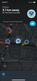
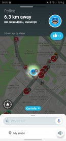
Police reports in Waze.
Waze has been struggling to find the right recipe for police reports within the app, and multiple approaches have been tested in the last months.Waze allows users to send three types of police reports: the standard report for a visible speed trap, a hidden radar, and police on the other side.
The simplified Waze reporting experience, which has already launched on all supported platforms, including Android Auto and CarPlay, tested multiple approaches, at one point giving up on all options but the standard police trap. The reasoning was simple: drivers don't care what type of speed trap they encounter; all they want to know is that they approach a radar, so keeping visible and hidden reports available as separate options only made the reporting experience more cluttered.
Waze eventually removed the police on the other side report, trying to focus on a single report. This option eventually returned, as it could help users, especially when traffic is light on the other side and nobody flags the location of a speed trap.
Police reports have slowly made their way to other navigation apps. Google Maps and Apple Maps also support similar options, though their adoption is lackluster. Apple Maps adopted police reports as part of the incident reporting component, trying to explore the navigation experience beyond the standard turn-by-turn guidance. The incident reports are bundled with the detailed city experience rolling out across the world, so it's not yet available for all users. Apple Maps also allows users to report accidents and "other hazards."
This is what the Ontario Provincial Police tries to highlight, too. Waze helps make a road more predictable, so even if the police location is marked on the map, the application still serves its purpose. It allows drivers to act in advance, allowing them to slow down safely without braking hard and increasing the risk of accidents.
Waze is available on Android and iPhone and can also run on Android Auto and CarPlay. It also includes a voice reporting component that allows users to send traffic reports without interacting with the screen, reducing distraction when the vehicle is in motion.
