There is now little doubt we humans will eventually get to Mars. It seems that, somehow, humanity has always known that. Yet only in recent years we got to see not only talk of Mars missions intensifying, but also plans being drafted.
At the moment the world's most potent space agency has its head wrapped around the Artemis missions, which will send humans around the Moon for the first time in ages as soon as next year. Because of the nature of the program, Artemis is most visible in the news.
But work on Mars missions continues behind the scenes, and at times we do get updates that reveal just how intense and advanced such work is. Like, did you know NASA has a pretty detailed map of where it can find water on the Red Planet?
The map is the result of an effort called Subsurface Water Ice Mapping. SWIM for short, it kicked off back in 2017 with the goal of giving us humans a better idea of where water can be found under the crust of the neighboring planet.
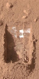
Although not visible in the form that we know it, water is abundant over on Mars. It can't be found in liquid form on the surface, because the thinness of the atmosphere would cause it to immediately vaporize, but it can be found elsewhere as ice: both under the ground, and at the planet's poles.
SWIM uses data gathered through a number of previous and some ongoing missions to Mars to get a pretty good idea of where ice can be found on the dead planet. The Mars Reconnaissance Orbiter (home to the mighty HiRISE that keeps bringing us incredible images of the Red Planet), the Mars Odyssey, and the Mars Global Surveyor all contributed something to the map NASA is creating.
The main focus of the program is to find ice in places that can easily be accessed by future astronauts. Normally, you'd think going for the poles would be the sensible thing to do, as there's a lot of it there. The problem is, these being planetary poles and all, they're so cold they're not even considered for robotic missions.
Luckily, the spacecraft mentioned above were able to detect "what look like masses of subsurface frozen water along Mars' mid-latitudes." And that's perfect, because mid-latitudes close to the equator are what NASA is gunning for for future Mars missions.
Landing a mission there has a number of advantages. First, the spacecraft itself will go through a slightly thicker atmosphere, making it easier for it to slow down. Then, such areas are also warmer, meaning a lot less energy would be needed to keep humans alive and machines running.
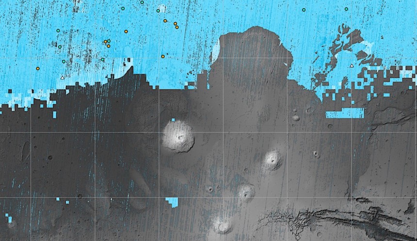
As per the available info, the regions currently known to have the most accessible subsurface ice are the Arcadia Planitia plain, and the Deuteronilus Mensae valley. Both are located ideally to provide enough ice and enough warmth.
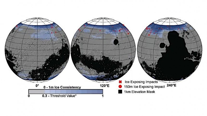
Areas in the northern hemisphere of the planet look particularly appealing in this respect, and many of them appear to have plenty of ice. At least that's what the most recent version of the SWIM map (the fourth since 2017), the most detailed to date, seems to be indicating.
This new version of the map used, for the first time, data from the HiRISE, and that helped "provide the most detailed perspective of the ice's boundary line as close to the equator as possible."
The instrument is used to find ice in several ways, including by looking at impact craters that may have excavated chunks of ice, and studying polygonal cracks on the surface resulting from the seasonal expansion and contraction of subsurface ice.
SWIM is a precursor (and an aid) for a dedicated ice mapping mission NASA is planning for 2026. Called Mars Ice Mapper, it's an orbiting spacecraft packing a powerful radar that will be used specifically for ice detection, based on the findings NASA already has on its map.
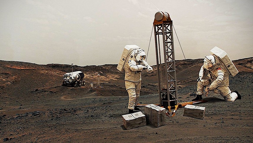
On top of that, the program may prove invaluable in helping humans select the spot on Mars the first crew of ours will reach in the not-so-distant future. Having access to water, no matter its form, would mean less of it will have to be transported from Earth, making room for other critical supplies.
A Mars mission would need water not only for the needs of its members but also to be used as an ingredient for rocket fuel for the return trip home. On a more scientific level, knowing where ice is buried would allow drilling for ice cores and learning a lot about the past of the planet.
SWIM could also help reveal why under surface water ice is more abundant in some places of the planet and less so in others. A better look at how the Martian climate evolved over time could be derived from that.
But work on Mars missions continues behind the scenes, and at times we do get updates that reveal just how intense and advanced such work is. Like, did you know NASA has a pretty detailed map of where it can find water on the Red Planet?
The map is the result of an effort called Subsurface Water Ice Mapping. SWIM for short, it kicked off back in 2017 with the goal of giving us humans a better idea of where water can be found under the crust of the neighboring planet.
Although not visible in the form that we know it, water is abundant over on Mars. It can't be found in liquid form on the surface, because the thinness of the atmosphere would cause it to immediately vaporize, but it can be found elsewhere as ice: both under the ground, and at the planet's poles.
SWIM uses data gathered through a number of previous and some ongoing missions to Mars to get a pretty good idea of where ice can be found on the dead planet. The Mars Reconnaissance Orbiter (home to the mighty HiRISE that keeps bringing us incredible images of the Red Planet), the Mars Odyssey, and the Mars Global Surveyor all contributed something to the map NASA is creating.
The main focus of the program is to find ice in places that can easily be accessed by future astronauts. Normally, you'd think going for the poles would be the sensible thing to do, as there's a lot of it there. The problem is, these being planetary poles and all, they're so cold they're not even considered for robotic missions.
Landing a mission there has a number of advantages. First, the spacecraft itself will go through a slightly thicker atmosphere, making it easier for it to slow down. Then, such areas are also warmer, meaning a lot less energy would be needed to keep humans alive and machines running.
As per the available info, the regions currently known to have the most accessible subsurface ice are the Arcadia Planitia plain, and the Deuteronilus Mensae valley. Both are located ideally to provide enough ice and enough warmth.
Areas in the northern hemisphere of the planet look particularly appealing in this respect, and many of them appear to have plenty of ice. At least that's what the most recent version of the SWIM map (the fourth since 2017), the most detailed to date, seems to be indicating.
This new version of the map used, for the first time, data from the HiRISE, and that helped "provide the most detailed perspective of the ice's boundary line as close to the equator as possible."
The instrument is used to find ice in several ways, including by looking at impact craters that may have excavated chunks of ice, and studying polygonal cracks on the surface resulting from the seasonal expansion and contraction of subsurface ice.
On top of that, the program may prove invaluable in helping humans select the spot on Mars the first crew of ours will reach in the not-so-distant future. Having access to water, no matter its form, would mean less of it will have to be transported from Earth, making room for other critical supplies.
A Mars mission would need water not only for the needs of its members but also to be used as an ingredient for rocket fuel for the return trip home. On a more scientific level, knowing where ice is buried would allow drilling for ice cores and learning a lot about the past of the planet.
SWIM could also help reveal why under surface water ice is more abundant in some places of the planet and less so in others. A better look at how the Martian climate evolved over time could be derived from that.


