It may go a bit against common sense, but the large ice formations on the surface of a planet, the things we usually call glaciers, are not exactly stationary. They flow, if you can believe that, at agonizingly slow speeds, prompting some in the scientific community to call them "solid rivers."
Earth has plenty of examples of them, and the main explanation for the large chunks of solid ice flowing in this or that direction is the action of gravity, which causes them not only to move, but also to deform.
Mars is another place where glaciers roamed freely not that long ago. We can see their remnants present at the polar caps, but also elsewhere on the planet, where "patterns of slow, viscous flow" are constantly being discovered by the many pieces of human-made hardware that constantly spy on the neighboring world.
The ice flow on the surface of a planet generally follows the path of least resistance, which in this case is always downhill (gravity, remember?). Depending on where this happens, various quantities of rock and soil go along for the ride.
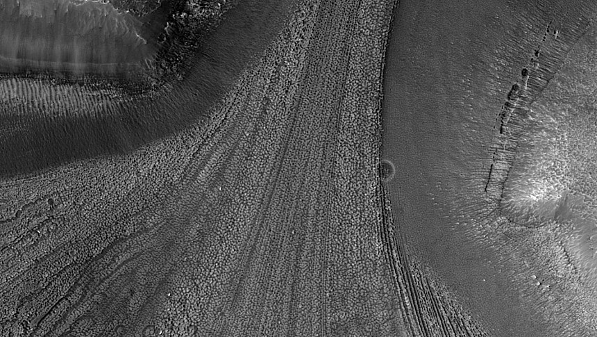
On Mars, once the ice melted, only the traces of rock and soil remained, neatly arranged in various patterns that always follow the direction of the ice flow. It is these tracks that have captured the attention of Earth-based scientists who are looking to advance their understanding of the Red Planet.
And it's exactly such an instance of glaciers leaving a footprint on the surface of Mars that we have here. It's an image of an undisclosed location up there, snapped from high up in orbit (297 km/184.4 miles) by a tool called the HiRISE.
The pic was captured back in April, but it was just made public by the people running the HiRISE spaceship, NASA, JPL, and the University of Arizona. Lika many such images (HiRISE sent back over the years tens of thousands of stills of the Red Planet), it reveals the surface of the planet in never-before-seen detail.
And it also helps us make a mental picture of how the place might have looked like many many years ago, when there was actual ice there. As per the details provided on this image, the traces of the flowing glacier could have formed over a period of thousands of years, during any of the planet's up to 20 ice ages that we know of.
Looking at the traces left behind can help people here on Earth get a better understanding of the history of the local ice flow. And even if that doesn't seem to help us in planning a future mission to Mars, it just might help us with our longer-term goal, that of colonizing the fourth planet from the Sun.


