Google Maps is a brilliant piece of technology, and while some people see it just as an advanced navigation solution that can take them from point A to point B faster and more conveniently, it’s actually a fully featured platform with tons of other features.
And the deeper the integration of Google Maps in a car, the more advanced its capabilities are becoming, as the Mountain View-based search giant has designed features that allow the app to play a key role in the overall driving experience.
In Android Automotive, for example, which comes pre-loaded on some cars as the default operating system, Google Maps can monitor battery level and automatically looks for charging stations along the route, therefore addressing range anxiety in a very straightforward manner.
But in the future, Google Maps could evolve from a piece of software helping drivers directly to one that could lend a hand to improving the traffic conditions in a completely different manner: by determining, monitoring, and reporting the quality of the roads you drive on.
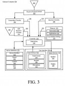
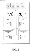
A recent Google patent provides us with a closer look at how everything is supposed to work if Google Maps becomes in charge of monitoring road quality.
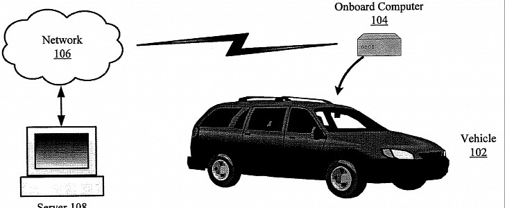
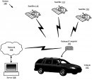
So technically, smartphones running Google Maps could all collect and sent road quality information to a central server where Google puts all the bits together and then tries to paint an accurate picture of every small section of a road.
The more devices send data, the bigger the chances for everything to be super-accurate, just like in the case of traffic information.
So theoretically, the Google Maps user base is already large enough to make such an implementation possible, especially as the navigation app already covers most of the planet and can accurately help determine the road you’re currently driving on.
Of course, the whole thing gets more difficult as you drive more and more, and this is why an advanced navigation solution like Google Maps is such a critical part of the system. Google’s tech can associate each batch of data with a section of the road using GPS information provided by Google Maps, so the data analysis process would eventually become not only faster and easier but more accurate too.
But Google says it doesn’t just have to rely on OBD2 systems for data collection, but also on technology that has been specifically developed to analyze road roughness.
“An exemplary response type road roughness meter is the Mays Ride Meter which consists of a tow vehicle and a trailer to measure 0.1 inch increments of vertical axle movement with respect to the trailer frame. A pavement condition recorder (“PCR”) is located in the tow vehicle to record all data collected which may then be processed through a data playback unit (“DPU”). Aggregating road quality information across many different routes using existing systems would require such substantial resources as to be impractical,” Google says.
Clearly, Google is looking into all kinds of approaches, but in the end, the best choice could be a mix of all these systems based on GPS information from Google Maps.
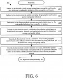
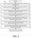
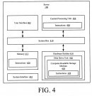
Google’s system could end up analyzing sensor data, road vibration, shocks, and other information sent by the mapping software to create one large batch of data that can then be further analyzed on a separate server.
“This data, together with the vehicle's location, may be transmitted through a mobile network to a central server for distribution in road quality reports and to improve driving directions in mapping software,” Google says.
What happens next could come down to authorities across the world. For example, Google could work together with state agencies to easily determine what roads need to be improved, though the same results could eventually be used to provide better navigation guidance, including for self-driving vehicles.
On paper, everything sounds pretty simple and easy to implement, but it goes without saying that making such an idea happen is a lot more difficult.
At the end of the day, however, it’s important to keep in mind this tech is still in the patent stage, so it’ll certainly be interesting to see if Google wants to make it happen at some point in the future.
In Android Automotive, for example, which comes pre-loaded on some cars as the default operating system, Google Maps can monitor battery level and automatically looks for charging stations along the route, therefore addressing range anxiety in a very straightforward manner.
But in the future, Google Maps could evolve from a piece of software helping drivers directly to one that could lend a hand to improving the traffic conditions in a completely different manner: by determining, monitoring, and reporting the quality of the roads you drive on.
A recent Google patent provides us with a closer look at how everything is supposed to work if Google Maps becomes in charge of monitoring road quality.
Collecting data from vehicles on the road
Before explaining how Google Maps could end up collecting the data related to road quality, the patent reveals that the whole system could rely on an approach that Google is already using for other purposes, including determining the traffic conditions: the army of mobile devices out there.So technically, smartphones running Google Maps could all collect and sent road quality information to a central server where Google puts all the bits together and then tries to paint an accurate picture of every small section of a road.
The more devices send data, the bigger the chances for everything to be super-accurate, just like in the case of traffic information.
So theoretically, the Google Maps user base is already large enough to make such an implementation possible, especially as the navigation app already covers most of the planet and can accurately help determine the road you’re currently driving on.
How the road quality data can be collected
Google explains in the patent that certain information can be collected from the sensors that are monitored by the ECU, so in theory, a device that’s plugged into the OBD2 port could already analyze such data to determine if a section of a road needs any improvements or not.Of course, the whole thing gets more difficult as you drive more and more, and this is why an advanced navigation solution like Google Maps is such a critical part of the system. Google’s tech can associate each batch of data with a section of the road using GPS information provided by Google Maps, so the data analysis process would eventually become not only faster and easier but more accurate too.
But Google says it doesn’t just have to rely on OBD2 systems for data collection, but also on technology that has been specifically developed to analyze road roughness.
“An exemplary response type road roughness meter is the Mays Ride Meter which consists of a tow vehicle and a trailer to measure 0.1 inch increments of vertical axle movement with respect to the trailer frame. A pavement condition recorder (“PCR”) is located in the tow vehicle to record all data collected which may then be processed through a data playback unit (“DPU”). Aggregating road quality information across many different routes using existing systems would require such substantial resources as to be impractical,” Google says.
Google’s system could end up analyzing sensor data, road vibration, shocks, and other information sent by the mapping software to create one large batch of data that can then be further analyzed on a separate server.
“This data, together with the vehicle's location, may be transmitted through a mobile network to a central server for distribution in road quality reports and to improve driving directions in mapping software,” Google says.
What happens next could come down to authorities across the world. For example, Google could work together with state agencies to easily determine what roads need to be improved, though the same results could eventually be used to provide better navigation guidance, including for self-driving vehicles.
On paper, everything sounds pretty simple and easy to implement, but it goes without saying that making such an idea happen is a lot more difficult.
At the end of the day, however, it’s important to keep in mind this tech is still in the patent stage, so it’ll certainly be interesting to see if Google wants to make it happen at some point in the future.
