TomTom is currently one of the industry leaders whenever it comes to geolocation technology and mapping solutions, so the company is constantly looking to improve its services with data that makes sense for customers.
And needless to say, one thing that always comes in handy is a more detailed map database, as end-users would eventually be able to figure out where they are and get additional contextual information in a more straightforward manner.
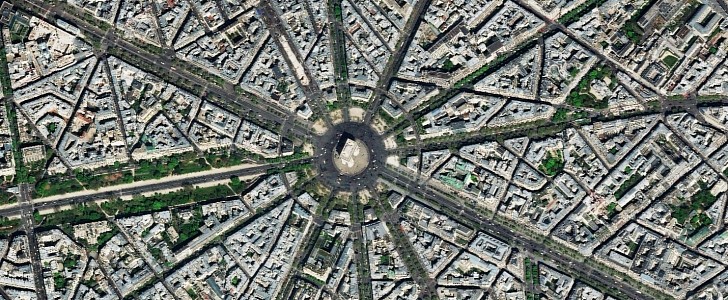
This is exactly what TomTom is now aiming for. The company has recently expanded its partnership with Maxar Technologies specifically to integrate high-resolution global satellite imagery into its products.
The quality of the data available via Maxar’s Vivid base maps is impressive, to say the least. For example, Vivid Advanced guarantees 30 cm resolution for the satellite imagery covering the most popular regions in the entire world. Obviously, it’s impossible to include the entire planet here, but the company says it already covers those regions that are considered to be of high interest.
Vivid Basic, on the other hand, offers 50 cm resolution imagery for the rest of the world.
The race for updating the imagery available for users out there is gaining pace these days.
Google itself has recently announced a new Google Maps update specifically to make it easier for users to figure out where they are by just looking at the screen. The application is getting new and more detailed maps that include additional information on every displayed location, including more accurate medians, sidewalks, crosswalks, and so on.
The idea is as simple as it could be: by re-creating the world in a digital version available on Google Maps, users can determine more accurately and more conveniently where they are. As a result, the navigation experience is a lot more straightforward when Google Maps is being used for getting directions to reach a specific address.


