Google Maps could soon expand its navigation capabilities with a safety feature that would automatically detect hazards in real-time and then issue warnings to the driver.
Detailed in patent number 11545036, the so-called “real-time driving behavior and safety monitoring” is a new capability that Google originally started to look into back in December 2019 when the first application was submitted.
The new system describes technology based on vehicle sensor data that helps Google’s software determine potential hazards and then issue a notification to the driver, therefore helping the person behind the wheel act accordingly.
At the end of the journey, Google says it can display a summary of the driving monitoring, including the number of alerts and other potential details regarding the detected hazards.
While similar systems have been around for a while, Google’s concept seems to push the driving monitoring solutions a step further. The company says that its implementation could allow for identifying objects and providing the right alerts based on the “type, location, and relative motions of the objects.”
In other words, Google envisions a set of different notifications, perhaps based on a severity rating, including audible and flashing notifications that would be displayed on the dashboard.
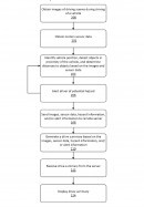
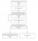
Google says all the data processing would take place both locally and in the cloud. Once the system receives the data from the vehicle sensors, including radar and infrared cameras, it uses its local processing power to identify the vehicle's position, the objects in its proximity, and the distance to them. The driver is then alerted of a potential hazard, while images, sensor data, hazard information, and the type of issued alert are automatically uploaded to a server for further analysis. Eventually, the server would send back the statistics that are displayed at the end of the journey.
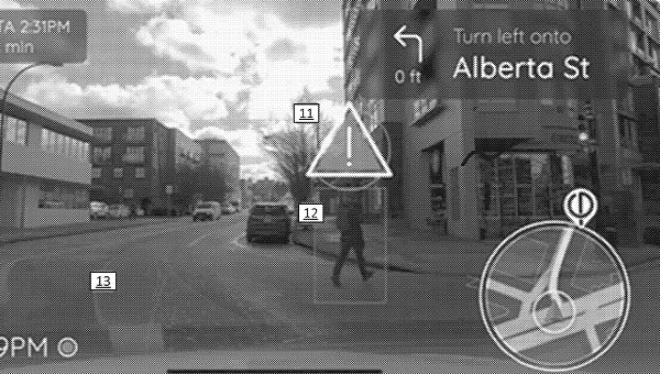
Google sees the whole concept as a proper fit for Google Maps, and it’s not hard to figure out how the whole thing could work. The navigation system, most likely running in Android Automotive cars (as this is the only way for Google’s services to get access to vehicle sensors), would provide an AR-powered experience where the potential hazards in front of the car are marked in real-time on the map.
An image included in the patent shows a pedestrian crossing the street and flagged as a potential hazard, with the rest of the navigation interface, including the next turn and the ETA, displayed in the top left and right corners. This would allow Google Maps to put focus on safety features without impacting the navigation experience.
While this is a feature that others have also developed, Google could turn it into a big incentive for automakers to bring Android Automotive to their cars. The adoption of the OS is still happening at a slow pace, with some companies, including BMW, specifically going for the open-source version to block Google from accessing vehicle data.
The new system is still a patent for now, so nobody knows for sure if Google has already decided to promote it to the production channel.


