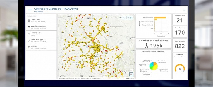
While most safety tech features are centered around the driver and his immediate response to certain traffic or road conditions, the new “Roadsafe” dashboard introduced by Ford shifts the focus to the infrastructure and helps create a long-term map that helps drivers, as well as authorities.
How many times did a pothole or junction end up ruining your day? It would be nice to know about things like potholes, roundabouts, badly-placed bus stops and many other similar things beforehand, so that we could avoid them altogether. Starting from now, that’s possible for those who will be using Ford’s new safety feature.
This digital tool is a “hotspot” map, where areas with a high incident risk are marked with red, and the ones with the lowest risk are marked with yellow. The information can then be used not just by individual drivers, but also by fleet managers looking to optimize their routes, as well as local authorities, who could warn other drivers and identify the infrastructure areas that need to be worked on.
How does the system work? An advanced algorithm puts together data coming from three different types of sources: connected vehicles, roadside sensors and accident reports. The vehicles record driving events such as braking and acceleration. The sensors detect near-miss incidents and analyze the movement patterns of non-connected vehicles, pedestrians and cyclists (with the data then being anonymized, for privacy protection). The final addition comes from historic accident data.
Ford worked with the Oxfordshire County Council, Loughborough University and Vivacity Labs (AI sensor developer), in a government-funded project (backed by the UK's innovation agency, Innovate UK), which unfolded over 20 months. The research began in Greater London and then was extended to Oxfordshire, with over 200 connected vehicles involved. This extensive project is the latest development in Ford’s four-year research for the RoadSafe technolgy.
This remarkable tool for predicting traffic incident locations could have an even wider application in the future, including helping autonomous vehicles anticipate and avoid potential hazards.


