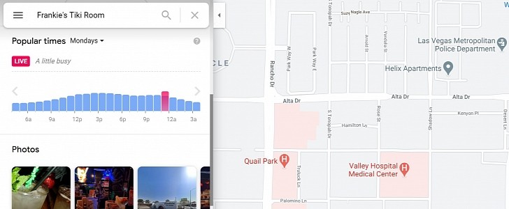
Google Maps is a fantastic app, there’s no doubt about it, and it comes in handy not only when you want to navigate from one point to another but also to get other details about a specific location on the map.
For example, during these crazy times, one of the Google Maps features that are truly useful for everybody is the live visit data, which shows how busy a certain business you highlight on the map currently is. And what’s more, Google itself has updated Google Maps back in 2020 with enhanced busyness data, all in an attempt to make it easier for everybody to visit a place at the most convenient time.
As it turns out, Apple too liked this feature, so the Cupertino-based tech giant is now working on bringing it to Apple Maps as well.
Without a doubt, this is good news for Apple Maps users, especially as Apple is working hard on making its app a more powerful alternative to Google Maps. According to a recent discovery, Apple wants to show how busy a place is using an approach that’s pretty similar to the one Google currently relies on for its very own service.
Apple explains that in order to determine if a place is busy or not, it uses location data collected when an app launches. The data is anonymized, though the wording used by Apple is a little vague and doesn’t clearly explain whether the information is transmitted when opening a first-party app or one from a third party.
“While you are in transit (for example, walking or driving), your iPhone will periodically send GPS data, travel speed, and barometric pressure information in an anonymous and encrypted form to Apple, to be used for augmenting crowd-sourced road traffic and atmospheric correction databases," Apple explains. "Additionally, when you open an app near a point of interest (for example, a business or park) your iPhone will send location data in an anonymous and encrypted form to Apple which Apple may aggregate and let users know if that point of interest is open and how busy it is.”
At this point, it’s still not known when Apple plans to bring this feature to Apple Maps, as the existing beta builds of iOS do not include such capabilities. What they do include, however, is a Waze-inspired incident reporting feature that allows Apple Maps users to report accidents, speed cameras, and various hazards, just like we can do it in the Google-owned app.

